Category:1870s maps of Iran
Countries of Asia: Afghanistan · Armenia‡ · Azerbaijan‡ · People's Republic of China · Cyprus‡ · Egypt‡ · Georgia‡ · India · Indonesia‡ · Iran · Iraq · Japan · Jordan · Lebanon · Pakistan · Philippines · Russia‡ · Syria · Turkey‡
Limited recognition: Abkhazia‡ · Taiwan · State of Palestine
‡: partly located in Asia
Limited recognition: Abkhazia‡ · Taiwan · State of Palestine
‡: partly located in Asia
Subcategories
This category has the following 2 subcategories, out of 2 total.
Media in category "1870s maps of Iran"
The following 8 files are in this category, out of 8 total.
-
 General Map of Central Asia - Plate 7 (1874).jpg 7,066 × 5,133; 6.68 MB
-
 Stieler, Adolf. Das Mittellandische Meer Und Nord-Afrika. 1875 BI.jpg 1,267 × 1,175; 469 KB
-

-

-
 Russisch-Türkisch-Persisch-Englische Grenzländer von Bosnien bis Kaschgar und Indien.jpg 8,524 × 6,883; 13.12 MB
-
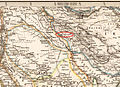
 Luristan 1875.jpg 972 × 946; 538 KB
-
 Luristan in 1875.jpg 801 × 582; 512 KB
-
 Persia with part of the Ottoman Empire, 1872.jpg 10,864 × 8,494; 16.44 MB
.jpg)

%27_(11113047764).jpg)
.jpg)


