Category:1814 maps of Asia
Temperate regions: North America · South America · Africa · Europe · Asia · Oceania – Polar regions: – Other regions:
English: 1814 maps of Asia
Español: Mapas de Asia en 1814
Media in category "1814 maps of Asia"
The following 7 files are in this category, out of 7 total.
-
 1814 Thomson Map of Tartary ( Mongolia, Tibet ) - Geographicus - Tartary-t-1814.jpg 3,500 × 2,912; 2.21 MB
-
 Asia according to the best authorities. LOC 2006636626.jpg 6,356 × 4,952; 3.52 MB
-
 Asia according to the best authorities. LOC 2006636626.tif 6,356 × 4,952; 90.05 MB
-
 Asia according to the best authorities. LOC 2007627523.jpg 6,222 × 4,920; 4.03 MB
-
 Asia according to the best authorities. LOC 2007627523.tif 6,222 × 4,920; 87.58 MB
-
 Asia, according to the best authorities. NYPL1404031.tiff 6,299 × 5,248; 94.6 MB
-
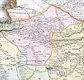 Khorasan in Safavid age.jpg 1,284 × 1,231; 1.52 MB
_-_Geographicus_-_Tartary-t-1814.jpg)


