Category:1816 maps of Asia
Temperate regions: North America · South America · Africa · Europe · Asia · – Polar regions: – Other regions:
English: 1816 maps of Asia
Español: Mapas de Asia en 1816
Subcategories
This category has the following 3 subcategories, out of 3 total.
Media in category "1816 maps of Asia"
The following 4 files are in this category, out of 4 total.
-
 Map of Asia by Daniel Philippidis.png 1,360 × 923; 2.73 MB
-
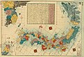 Map of three lands surrounding Japan (14558273178).jpg 2,500 × 1,688; 1.85 MB
-
 NOTICE TO ACCOMPANY THE CHART OF THE WEST COAST OF COREA.jpg 566 × 763; 57 KB
-
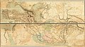 Outlines of the Countries Between Delhi and Constantinople By A. Arrowsmith 1814. Additions to 1816.jpg 51,566 × 29,000; 367.93 MB

.jpg)

