Category:1815 maps
| ← · 1810 · 1811 · 1812 · 1813 · 1814 · 1815 · 1816 · 1817 · 1818 · 1819 · → |
Deutsch: Karten mit Bezug zum Jahr 1815
English: Maps related to the year 1815
Español: Mapas relativos al año 1815
Français : Cartes concernant l’an 1815
Русский: Карты 1815 года
Subcategories
This category has the following 7 subcategories, out of 7 total.
Media in category "1815 maps"
The following 65 files are in this category, out of 65 total.
-
1815 Thomson Map of Attica (Anthens and Vicinity) Greece - Geographicus - Attica-t-1814.jpg 4,010 × 5,604; 3.19 MB
-
A map of the seat of war at New Orleans. LOC 2012591006.tif 4,076 × 3,002; 35.01 MB
-
Attack on the American lines near New Orleans Dec. 1814 and Jan. 1815 LOC 2012591008.jpg 4,888 × 4,251; 2.51 MB
-
Citadel of Saigon 1815.png 640 × 469; 442 KB
-
Droysens-25h.jpg 987 × 848; 798 KB
-
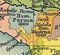
Emilia Occidentale 1815.jpg 367 × 334; 54 KB
-
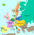
Europa 1815-es.svg 1,340 × 1,363; 1 MB
-
Europa 1815-pt.svg 1,340 × 1,363; 559 KB
-
Europa 1815.svg 1,340 × 1,363; 554 KB
-
Europa 1818-es.svg 905 × 762; 1.41 MB
-
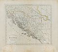
Illyria 1815.jpg 2,223 × 1,972; 574 KB
-
Invasion of France in 1815.jpg 1,827 × 2,368; 3.61 MB
-
Landkarte von dem Reiche der Ehre.jpg 5,942 × 4,923; 8.65 MB
-
Landkarte von dem Reiche der Herrschaft.jpg 5,828 × 5,078; 8.61 MB
-
Les bassins de Chalon .jpg 2,135 × 1,376; 1.05 MB
-
Map Italy in 1815- Touring Club Italiano CART-TRC-49 01.jpg 3,230 × 4,205; 1.65 MB
-
Map of a part of Pantonia laid out in sections. LOC 2013585028.jpg 7,678 × 9,907; 9.04 MB
-
Map of a part of Pantonia laid out in sections. LOC 2013585028.tif 7,678 × 9,907; 217.63 MB
-
Map of area from Pensacola Bay to St. Andrew's Bay, Spanish West Florida. LOC 2013585056.jpg 6,418 × 5,068; 4.09 MB
-
Map of area from Pensacola Bay to St. Andrew's Bay, Spanish West Florida. LOC 2013585056.tif 6,418 × 5,068; 93.06 MB
-
Map of Persia and Adjacent Countries, for Sir John Malcolm's History of Persia.tif 1,252 × 1,024; 3.67 MB
-
New Orleans and Louisiana 1815.jpg 6,466 × 4,786; 2.65 MB
-
Civic Center - Map Detail visitors.jpg 1,067 × 1,600; 272 KB
-
Civic Center - Map detail.jpg 1,067 × 1,600; 324 KB
-
Part of Belgium engraved by J. Kirkwood.jpg 3,174 × 2,029; 4.66 MB
-
Plan of New Orleans and Suburbs 1815.jpg 540 × 322; 42 KB
-
Plan of the city and suburbs of New Orleans - from an actual survey made in 1815 LOC 90684205.tif 9,380 × 6,002; 161.07 MB
-
Plano de la Bahía de Panzacola y sus immediaciones LOC 2013585053.jpg 6,283 × 5,502; 4.49 MB
-
Plano de la Bahía de Panzacola y sus immediaciones LOC 2013585053.tif 6,283 × 5,502; 98.9 MB
-
Plano del Rio Apalachicola, territorio é yslas adyacentes LOC 2013585027.jpg 6,487 × 9,197; 6.73 MB
-
Plano del Rio Apalachicola, territorio é yslas adyacentes LOC 2013585027.tif 6,487 × 9,197; 170.69 MB
-
Portsea islandcanal1815.jpg 3,042 × 1,719; 2.56 MB
-
Territoire de Columbia LOC 91686258.jpg 3,590 × 3,481; 2.3 MB
-
Territoire de Columbia LOC 91686258.tif 3,590 × 3,481; 35.75 MB
-
Tranchot-Gut-Rox.jpg 2,849 × 2,007; 546 KB
-
Unidentified plan of a portion of Pensacola, Spanish West Florida. LOC 2013585069.jpg 4,127 × 5,798; 2.62 MB
-
Unidentified plan of a portion of Pensacola, Spanish West Florida. LOC 2013585069.tif 4,127 × 5,798; 68.46 MB
-
Western hemisphere (2673902439).jpg 1,789 × 2,000; 2.76 MB
-
Écolemilitairelaflèche.jpg 7,462 × 5,714; 8.92 MB
-
Фрагмент карты 1815 г..png 1,839 × 937; 3.9 MB


