Category:1811 maps
| ← · 1810 · 1811 · 1812 · 1813 · 1814 · 1815 · 1816 · 1817 · 1818 · 1819 · → |
Deutsch: Karten mit Bezug zum Jahr 1811
English: Maps related to the year 1811
Español: Mapas relativos al año 1811
Français : Cartes concernant l’an 1811
Русский: Карты 1811 года
Subcategories
This category has the following 6 subcategories, out of 6 total.
Media in category "1811 maps"
The following 49 files are in this category, out of 49 total.
-
DUBLIN(1811) p010 A PLAN OF THE CITY OF DUBLIN.jpg 4,398 × 3,408; 8.54 MB
-
(1811) MAP OF THE WORLD.jpg 4,609 × 2,408; 2.69 MB
-
(1811) MAP OF HOLLAND.jpg 2,457 × 3,168; 1.75 MB
-
(1811) MAP OF POLAND.jpg 3,138 × 2,486; 1.89 MB
-
(1811) MAP OF IRELAND.jpg 2,400 × 3,090; 1.87 MB
-
(1811) MAP OF HINDOOSTAN.jpg 2,408 × 3,136; 1.67 MB
-
(1811) MAP OF WEST INDIES.jpg 3,145 × 2,500; 1.68 MB
-
PERM(1811) p1.415.jpg 4,423 × 3,527; 9.6 MB
-
1811 Cary Map of the Kingdom of Portugal - Geographicus - Portugal-cary-1811.jpg 3,000 × 2,669; 1.69 MB
-
Allgemeine Welt-Karte, 1811.jpg 5,059 × 5,327; 6.17 MB
-
Baierische Monarchie von Conrad Mannert 1811.jpg 9,756 × 16,800; 67.16 MB
-
Becon.Plan.cadastral.1811.Archives.Hauts.de.Seine.jpg 941 × 628; 65 KB
-
Carte itinéraire du département du Bas-Rhin - 1811.jpg 7,665 × 12,377; 11.55 MB
-
Charte vom Osmannischen Reiche in Asien (FL35866786 2714560).jpg 10,046 × 7,488; 101.51 MB
-
ClumFarmMap.jpg 7,158 × 5,677; 29.71 MB
-
ClumFarmMapUnrestored.jpg 7,432 × 6,000; 29.59 MB
-
Das itzige Königreich Baiern nach seinem politischen Zustand von 1180.jpg 5,720 × 9,157; 24.51 MB
-
Geognostische Karte der Schweiz.JPG 2,126 × 1,299; 171 KB
-
Hardy Town 1811 map.jpg 709 × 592; 257 KB
-
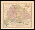
John Cary, A new map of Hungary with its divisions into Gespanchafts or Counties (FL35075177 2539120).jpg 15,122 × 12,957; 253.29 MB
-
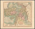
John Cary, A new map of Turkey in Asia (FL36010909 2717020).jpg 15,258 × 12,689; 278.26 MB
-
John Martin, The land of Canaan as Divided Among the Twelve Tribes (FL45605201 3942173).jpg 2,503 × 2,022; 1.32 MB
-
Looking at the comet till you get a criek in the neck RMG F8649.tiff 3,623 × 5,400; 55.97 MB
-
Map - Special Collections University of Amsterdam - OTM- HB-KZL 34.27.04.tif 9,688 × 6,480; 179.61 MB
-
Map of Nepaul.jpg 5,000 × 3,134; 2.8 MB
-
Map of the Mississippi River from its source to the mouth of the Missouri. LOC 78692257.jpg 9,225 × 2,900; 2.85 MB
-
Map of the Mississippi River from its source to the mouth of the Missouri. LOC 78692257.tif 9,225 × 2,900; 76.54 MB
-
Map of the world with the most recent discoveries. LOC 99463788.jpg 3,460 × 1,890; 1.2 MB
-
Map of the world with the most recent discoveries. LOC 99463788.tif 3,460 × 1,890; 18.71 MB
-
Nozay 1811 occupation du sol.jpg 1,754 × 1,240; 653 KB
-
Plan général de la prison criminelle de Vannes (1811).jpg 705 × 512; 330 KB
-
Reichborns kart over Christiania, 1811.jpg 3,100 × 2,269; 1.16 MB
-
Revised map of Japan, showing provinces in five colours (14498335027).jpg 2,500 × 1,892; 1.64 MB
-
Samuel John Neele, Ireland (FL35475125 2582264).jpg 4,859 × 6,240; 43.81 MB
-
Schweinau Steinbühl Katasterplan 1811 001.JPG 2,341 × 2,343; 639 KB
-
Seevermessungs-Karte Lübecker Bucht - 1811, 1815.JPG 8,121 × 12,479; 9.51 MB
-
Survey of the Roads and Foot paths in the Parish of Islington.jpg 3,666 × 5,702; 3.28 MB
-
Wöhrd Katasterplan 1811 001.JPG 2,430 × 2,415; 1.38 MB


