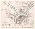
Category:1830s maps of Saxony
|
Federal states of Germany: |
Subcategories
This category has the following 7 subcategories, out of 7 total.
- 1830 maps of Saxony (2 F)
- 1831 maps of Saxony (1 F)
- 1837 maps of Saxony (empty)
F
L
- Oberreit, Sect. Leipzig, 1836–39 (54 F)
O
- Oberreit, Sect. Oschatz, 1839–40 (116 F)
Media in category "1830s maps of Saxony"
The following 6 files are in this category, out of 6 total.
-
1833 map of Dresden.jpg 9,537 × 7,924; 12.56 MB
-
Das Lausitzer Gebirge und die umliegenden Gegenden.jpg 7,373 × 6,029; 17.54 MB
-
Chemnitz 1829-1831.jpg 7,464 × 6,554; 20.16 MB
-
Freiberg.jpg 7,468 × 6,573; 21.1 MB
-
Johann Georgenstadt.jpg 7,431 × 6,603; 14.57 MB
-
Panorama der Eisenbahn zwischen Leipzig und Dresden.jpg 35,185 × 4,340; 77.42 MB


