Category:1840s maps of the United Kingdom
Countries of Europe: Albania · Armenia‡ · Austria · Azerbaijan‡ · Belarus · Belgium · Bosnia and Herzegovina · Bulgaria · Croatia · Cyprus‡ · Czech Republic · Denmark · Finland · France‡ · Georgia‡ · Germany · Greece · Hungary · Republic of Ireland · Italy · Lithuania · Netherlands‡ · Norway · Poland · Portugal‡ · Romania · Russia‡ · Serbia · Slovakia · Slovenia · Spain‡ · Sweden · Switzerland · Turkey‡ · Ukraine · United Kingdom
Limited recognition: Abkhazia‡
‡: partly located in Europe
Limited recognition: Abkhazia‡
‡: partly located in Europe
Subcategories
This category has the following 7 subcategories, out of 7 total.
Media in category "1840s maps of the United Kingdom"
The following 2 files are in this category, out of 2 total.
-
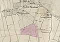 Potternewton map from 1842.jpg 1,473 × 1,014; 649 KB
-
 HEINZELMANN(1848) 03.585 Kartenblatt Großbritannien und Irland.jpg 3,795 × 3,138; 3.08 MB

_03.585_Kartenblatt_Gro%C3%9Fbritannien_und_Irland.jpg)