Category:1849 maps of Germany
Countries of Europe: Austria · France‡ · Germany · Italy · Norway · Spain‡ · Switzerland · United Kingdom
‡: partly located in Europe
‡: partly located in Europe
Federal states of Germany:
Media in category "1849 maps of Germany"
The following 8 files are in this category, out of 8 total.
-
 Ancient germania.jpg 1,964 × 1,619; 824 KB
-
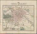
 Boehm Grundriss von Berlin mit nächster Umgebung 1849 (Panke u Neue Panke).jpg 2,416 × 2,522; 2.5 MB
-
 Boehm Grundriss von Berlin mit nächster Umgebung 1849.jpg 10,639 × 9,628; 25.65 MB
-
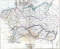
 German Empire (1849).png 2,021 × 2,048; 459 KB
-
 Map of Bremerhaven 1849 2011 11 27 Hochhaus.jpg 880 × 636; 521 KB
-
 Map of Bremerhaven 1849.jpg 1,772 × 1,328; 2.13 MB
-
 Meyer‘s Zeitungsatlas 009 – General-Karte von Deutschland.jpg 7,358 × 6,224; 14.08 MB
-
 Meyer‘s Zeitungsatlas 021 – Preussen.jpg 5,804 × 4,325; 11.9 MB

.jpg)

.png)


