Category:1852 maps of Massachusetts
States of the United States: California · Connecticut · Florida · Louisiana · Massachusetts · New York · Oregon · Pennsylvania · Texas · Utah
| ← 1850 1851 1852 1853 1854 1855 1856 1857 1858 1859 → |
Media in category "1852 maps of Massachusetts"
The following 23 files are in this category, out of 23 total.
-

-
 1852 Shields Wall Map of Boston and Vicinity - Geographicus - Boston-shields-1852.jpg 2,008 × 1,926; 511 KB
-

-
 Andover, 1852. LOC 2011589238.jpg 12,655 × 9,192; 12.18 MB
-
 Andover, 1852. LOC 2011589238.tif 12,655 × 9,192; 332.81 MB
-
 Cochituate Aqueduct (Massachusetts) map, 1852.jpg 3,730 × 1,496; 4.6 MB
-
 Map of Concord, Mass., 1852.tif 7,886 × 6,258; 141.21 MB
-
 Map of Somerville, Mass. (2674605704).jpg 2,000 × 1,343; 2.07 MB
-
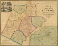
 Map of the town of Concord (3856488100).jpg 9,032 × 6,960; 10.69 MB
-
 Map of the town of Concord, Middlesex County Mass. LOC 2012593522.jpg 9,414 × 7,452; 9.21 MB
-
 Map of the town of Concord, Middlesex County Mass. LOC 2012593522.tif 9,414 × 7,452; 200.71 MB
-
 Map of the town of Medfield (2674728663).jpg 1,782 × 2,000; 3.21 MB
-
 Map of the town of Medfield LOC 2008624185.jpg 11,332 × 13,008; 17.95 MB
-
 Map of the town of Medfield LOC 2008624185.tif 11,332 × 13,008; 421.73 MB
-
 Map of the town of Medway, Norfolk Co., Mass. (7537860566).jpg 2,000 × 1,342; 2.37 MB
-
 Map of the town of Needham, Mass. (4586562397).jpg 2,000 × 1,448; 2.1 MB
-
 Map of the town of Walpole Norfolk County Mass. (3719858597).jpg 722 × 1,024; 582 KB
-
-
 Massachusetts map by George W. Boynton, 1852.jpg 4,693 × 3,329; 5.97 MB
-
 Plan of a part of Cambridge showing the location of the Fayerweather Estate (3855696875).jpg 2,000 × 1,554; 2.38 MB
-
 Plan of land in Ayers New-City, Lowell, Mass. (4587187052).jpg 1,345 × 2,000; 2.07 MB
-
 Plan of the city of Lynn Mass. from actual surveys (3720088313).jpg 1,024 × 797; 656 KB
-
 WatertownBranchRRmap1852.png 964 × 722; 1.7 MB


.jpg)
.jpg)

.jpg)

.jpg)
.jpg)
.jpg)


.jpg)
.jpg)
.jpg)

_map,_1852.jpg)