Category:1855 maps of Illinois
States of the United States: California · Connecticut · Florida · Illinois · Louisiana · Massachusetts · Missouri · New Mexico · New York · Ohio · Oregon · Pennsylvania · Rhode Island · Texas · Utah · Vermont · Washington – Washington, D.C.
| ← 1855 1857 → |
Media in category "1855 maps of Illinois"
The following 6 files are in this category, out of 6 total.
-
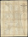
 1855 Chicago map by Colton.jpg 3,763 × 5,413; 7.53 MB
-
 1855 Chicago map by Hall & Co.jpg 8,154 × 10,614; 20.73 MB
-

-

-
 Macoupin County excerpt from 1855 Illinois county map.JPG 187 × 274; 30 KB
-


.jpg)