Category:1855 maps of Ohio
States of the United States: California · Connecticut · Florida · Illinois · Louisiana · Massachusetts · Missouri · New Mexico · New York · Ohio · Oregon · Pennsylvania · Rhode Island · Texas · Utah · Washington – Washington, D.C.
| ← 1850 1851 1854 1855 1856 1857 1858 → |
Media in category "1855 maps of Ohio"
The following 13 files are in this category, out of 13 total.
-
 1855 Colton Map of Ohio - Geographicus - Ohio-colton-1855.jpg 4,000 × 3,268; 4.23 MB
-

-
 Lucas County Ohio map by Riley, 1855.jpg 7,708 × 5,363; 7.58 MB
-
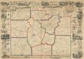
 Map of Butler County, Ohio (13411325544).jpg 2,000 × 1,549; 3.26 MB
-
 Map of Butler County, Ohio LOC 2012592388.jpg 18,364 × 14,518; 33.98 MB
-
 Map of Butler County, Ohio LOC 2012592388.tif 18,364 × 14,518; 762.77 MB
-
 Map of Gallia and Meigs County oil field LOC 2012591125.jpg 8,387 × 11,221; 13.84 MB
-
 Map of Gallia and Meigs County oil field LOC 2012591125.tif 8,387 × 11,221; 269.25 MB
-
 Map of Greene County, Ohio LOC 2012591127.tif 15,732 × 11,138; 501.32 MB
-
 Map of Guernsey County, Ohio LOC 2012591122.jpg 12,981 × 11,215; 21.11 MB
-
 Map of Guernsey County, Ohio LOC 2012591122.tif 12,981 × 11,215; 416.51 MB
-
 New map of Stark County, Ohio LOC 2012592393.jpg 15,750 × 13,148; 26.9 MB
-
 New map of Stark County, Ohio LOC 2012592393.tif 15,750 × 13,148; 592.46 MB


.jpg)


