Category:1854 maps of Ohio
States of the United States: California · Georgia · Massachusetts · New York · Ohio · Oregon · Pennsylvania · Texas
| ← 1850 1851 1854 1855 1856 1857 1858 → |
Media in category "1854 maps of Ohio"
The following 14 files are in this category, out of 14 total.
-
 Ashtabula Harbor, Ohio - NARA - 78117583.jpg 7,488 × 4,448; 2.08 MB
-

-

-
 Conneaut Harbor Ohio - NARA - 78117580.jpg 5,952 × 3,841; 1.28 MB
-
 Conneaut Harbor, Ohio - NARA - 112061556.jpg 10,796 × 7,447; 3.28 MB
-
 Floraville 1854 .jpg 6,910 × 3,887; 17.67 MB
-
 Map of Licking County, Ohio LOC 2012591114.jpg 13,940 × 11,290; 24.07 MB
-
 Map of Licking County, Ohio LOC 2012591114.tif 13,940 × 11,290; 450.28 MB
-
 Map of Licking County, Ohio LOC 2012591115.jpg 13,671 × 11,362; 23.59 MB
-
 Map of Morgan County, Ohio LOC 2012592408.jpg 10,915 × 8,233; 15.59 MB
-
 Map of Morgan County, Ohio LOC 2012592408.tif 10,915 × 8,233; 257.1 MB
-
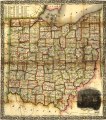 Railroad & township map of Ohio. LOC 98688538.tif 8,430 × 9,545; 230.21 MB
-

-
 View of Columbus O. From Capitol University.png 13,796 × 8,091; 139.82 MB


.jpg)
