Category:1862 maps of Florida
States of the United States: California · Delaware · Florida · Illinois · Kansas · Kentucky · Louisiana · Maryland · Massachusetts · Mississippi · Nevada · New Hampshire · New Mexico · New York · North Carolina · Pennsylvania · South Carolina · Tennessee · Utah · Vermont · Virginia · West Virginia
| ← 1860 1861 1862 1864 |
Media in category "1862 maps of Florida"
The following 8 files are in this category, out of 8 total.
-
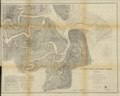
 Fort Pickens, Florida LOC gvhs01.vhs00202.jpg 1,435 × 1,772; 506 KB
-
 Fort Pickens, Florida LOC gvhs01.vhs00202.tif 1,435 × 1,772; 7.28 MB
-
 Preliminary chart of St. Augustine harbor, Florida LOC 99447281.jpg 6,357 × 6,389; 5.16 MB
-
 Preliminary chart of St. Augustine harbor, Florida LOC 99447281.tif 6,357 × 6,389; 116.2 MB
-

-

-
 St. Mary's River and Fernandina harbor, Florida LOC 99447282.jpg 9,850 × 7,885; 17.03 MB
-
 St. Mary's River and Fernandina harbor, Florida LOC 99447282.tif 9,850 × 7,885; 222.21 MB


