Category:1862 maps of Virginia
States of the United States: California · Delaware · Florida · Illinois · Kansas · Kentucky · Louisiana · Maryland · Mississippi · Nevada · New Mexico · New York · North Carolina · Pennsylvania · South Carolina · Tennessee · Utah · Virginia · West Virginia
| 1860 1861 1862 1863 1864 1865 1866 1867 |
Subcategories
This category has the following 5 subcategories, out of 5 total.
D
- Distances, 1862 - (Virginia) (20 F)
S
Media in category "1862 maps of Virginia"
The following 200 files are in this category, out of 611 total.
(previous page) (next page)-
(Map of the Shenandoah Valley). LOC 99446754.jpg 11,189 × 24,467; 39.27 MB
-
(Sketch map of White Oak Swamp and vicinity southeast of Richmond.) - NARA - 305588.tif 4,800 × 3,066; 42.11 MB
-
(Yorktown to Williamsburg) LOC 99448868.jpg 4,697 × 7,081; 5.03 MB
-
(Yorktown to Williamsburg) LOC 99448868.tif 4,697 × 7,081; 95.16 MB
-
1862 map of the James River. LOC gvhs01.vhs00391.jpg 3,941 × 2,460; 1,001 KB
-
1862 map of the James River. LOC gvhs01.vhs00391.tif 3,941 × 2,460; 27.74 MB
-
A part of Henrico County LOC gvhs01.vhs00365.jpg 9,525 × 7,200; 8.2 MB
-
A part of Henrico County LOC gvhs01.vhs00365.tif 9,525 × 7,200; 196.21 MB
-
Abraham Lincoln - a history (1914) (14769856592).jpg 2,148 × 2,412; 1.57 MB
-
Approaches of A. of P. to Fredericksburg. LOC 99446528.jpg 5,059 × 4,138; 2.32 MB
-
Approaches of A. of P. to Fredericksburg. LOC 99446528.tif 5,059 × 4,138; 59.89 MB
-
Battle field of Young's Branch or Manassa(s), battle fought July 21, 1861 LOC 89692757.jpg 5,604 × 6,101; 6.71 MB
-
Battle field of Young's Branch or Manassa(s), battle fought July 21, 1861 LOC 89692757.tif 5,604 × 6,101; 97.82 MB
-
Battle field of Young's Branch or Manassa(s), battle fought July 21, 1861 LOC lva0000021.jpg 7,340 × 8,027; 12.87 MB
-
Battle field of Young's Branch or Manassa(s), battle fought July 21, 1861 LOC lva0000021.tif 7,340 × 8,027; 168.57 MB
-
Battle of Beaver Dam Creek, map.jpg 2,172 × 1,935; 814 KB
-
Battle of Beaverdam Creek Va., Chickahominy River, June 27th 1862 LOC gvhs01.vhs00216.tif 2,172 × 1,935; 12.02 MB
-
Battle of Chantilly Va. LOC gvhs01.vhs00106.jpg 1,692 × 2,166; 694 KB
-
Battle of Chantilly Va. LOC gvhs01.vhs00106.tif 1,692 × 2,166; 10.49 MB
-
Battle of Fredericksburg. Dec. 13, 1862. LOC 99439203.jpg 1,714 × 2,952; 1.17 MB
-
Battle of Fredericksburg. Dec. 13, 1862. LOC 99439203.tif 1,714 × 2,952; 14.48 MB
-
Battle of Hanover Court House, Virginia, May 26, 1862 LOC gvhs01.vhs00213.jpg 2,528 × 1,537; 896 KB
-
Battle of Hanover Court House, Virginia, May 26, 1862 LOC gvhs01.vhs00213.tif 2,528 × 1,537; 11.12 MB
-
Battle of Kernstown, Sunday, 23 March, 1862 LOC 99446755.jpg 3,379 × 4,531; 1.81 MB
-
Battle of Malvern Hill showing Magruder's 1st attack June 30th LOC gvhs01.vhs00095.jpg 1,674 × 2,179; 720 KB
-
Battle of Malvern Hill showing Magruder's 1st attack June 30th LOC gvhs01.vhs00095.tif 1,674 × 2,179; 10.44 MB
-
Battlefield of Bull Run August 29th and 30th 1862. LOC gvhs01.vhs00220.jpg 3,227 × 2,338; 1.36 MB
-
Battlefield of Bull Run August 29th and 30th 1862. LOC gvhs01.vhs00220.tif 3,227 × 2,338; 21.59 MB
-
Battlefield of Cedar Mountain, August 9th, 1862 LOC 99439116.jpg 1,972 × 3,252; 1.22 MB
-
Battlefield of Cedar Mountain, August 9th, 1862 LOC 99439116.tif 1,972 × 3,252; 18.35 MB
-
Campaign maps Army of the Potomac Map no. 2. Williamsburg to White House (5960826751).jpg 1,765 × 2,000; 2.35 MB
-
Central Virignia LOC 99448507.jpg 10,138 × 8,284; 16.19 MB
-
Central Virignia LOC 99448507.tif 10,138 × 8,284; 240.28 MB
-
Civil War newspaper maps from the New York times and the New York herald LOC 2002626099-16.jpg 9,768 × 7,056; 12.22 MB
-
Civil War newspaper maps from the New York times and the New York herald LOC 2002626099-23.tif 4,567 × 6,451; 84.29 MB
-
Civil War newspaper maps from the New York times and the New York herald LOC 2002626099-27.jpg 9,624 × 6,768; 11.51 MB
-
Civil War newspaper maps from the New York times and the New York herald LOC 2002626099-27.tif 9,624 × 6,768; 186.35 MB
-
Civil War newspaper maps from the New York times and the New York herald LOC 2002626099-28.tif 4,666 × 6,314; 84.29 MB
-
Civil War newspaper maps from the New York times and the New York herald LOC 2002626099-32.tif 9,654 × 6,576; 181.63 MB
-
Civil War proof maps - United States LOC 2002626097-11.jpg 6,088 × 7,996; 6.22 MB
-
Coast of North Carolina & Virginia (5139835096).jpg 1,375 × 2,000; 1.85 MB
-
Coast of North Carolina & Virginia LOC 99447449.jpg 8,743 × 12,351; 13.36 MB
-
Coast of North Carolina & Virginia LOC 99447449.tif 8,743 × 12,351; 308.95 MB
-
Colton's Virginia. LOC lva0000093.jpg 5,116 × 4,312; 5.45 MB
-
Colton's Virginia. LOC lva0000093.tif 5,116 × 4,312; 63.11 MB
-
Contours of Union forts on south side of Potomac, 1862 (map). LOC gvhs01.vhs00242.jpg 4,339 × 4,312; 2.35 MB
-
Contours of Union forts on south side of Potomac, 1862 (map). LOC gvhs01.vhs00242.tif 4,339 × 4,312; 53.53 MB
-
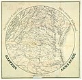
Eastern army guide - one hundred and fifty miles around Richmond. LOC lva0000019.jpg 8,691 × 8,485; 13.31 MB
-
Eastern army guide - one hundred and fifty miles around Richmond. LOC lva0000019.tif 8,691 × 8,485; 210.98 MB
-
Encampment of U.St. troops at Newport News, Va., 1861 & 1862 LOC 2003684436.jpg 7,038 × 4,484; 5.03 MB
-
Encampment of U.St. troops at Newport News, Va., 1861 & 1862 LOC 2003684436.tif 7,038 × 4,484; 90.29 MB
-
FallsChurchCivilWarMap (cropped).jpeg 451 × 357; 43 KB
-
FallsChurchCivilWarMap.jpeg 1,128 × 888; 212 KB
-
Fort Lyon Diagram.jpg 4,203 × 2,656; 11.51 MB
-
Fortress Monroe, Va. and its vicinity (2674995884).jpg 2,000 × 1,577; 2.15 MB
-
Fortress Monroe, Va. and its vicinity LOC 99439195.jpg 3,002 × 2,417; 1.17 MB
-
Fortress Monroe, Va. and its vicinity LOC 99439195.tif 3,002 × 2,417; 20.76 MB
-
Geological map of the state of Virginia LOC 99446495.jpg 14,311 × 9,359; 22.51 MB
-
Geological map of the state of Virginia LOC 99446495.tif 14,311 × 9,359; 383.2 MB
-
Harrison's Landing, Va. - Showing Union line of defence (sic). LOC gvhs01.vhs00042.jpg 4,592 × 5,638; 2.29 MB
-
Harrison's Landing, Va. - Showing Union line of defence (sic). LOC gvhs01.vhs00042.tif 4,592 × 5,638; 74.07 MB
-
Henrico County, Virginia, 1862. LOC 2006626062.jpg 4,957 × 4,045; 1.68 MB
-
Henrico County, Virginia, 1862. LOC 2006626062.tif 4,957 × 4,045; 57.37 MB
-
Johnson's Pennsylvania, Virginia, Delaware, and Maryland LOC lva0000077.jpg 8,026 × 5,591; 11.6 MB
-
Lloyd's new war map of Virginia. LOC 99448496.jpg 8,299 × 5,126; 8.76 MB
-
Lloyd's new war map of Virginia. LOC 99448496.tif 8,299 × 5,126; 121.71 MB
-
Map of a portion of Virginia LOC 2002627441.jpg 5,297 × 5,731; 3.05 MB
-
Map of a portion of Virginia LOC 2002627441.tif 5,297 × 5,731; 86.85 MB
-
Map of a portion of Virginia LOC 83695218.jpg 5,288 × 5,780; 3.78 MB
-
Map of a portion of Virginia LOC 83695218.tif 5,288 × 5,780; 87.45 MB
-
Map of Caroline County, Va. LOC 2002627427.jpg 9,281 × 7,673; 8.51 MB
-
Map of Caroline County, Va. LOC 2002627427.tif 9,281 × 7,673; 203.74 MB
-
Map of Cedar Mountain and vicinity - and battle. LOC gvhs01.vhs00097.jpg 1,879 × 2,236; 765 KB
-
Map of Cedar Mountain and vicinity - and battle. LOC gvhs01.vhs00097.tif 1,879 × 2,236; 12.02 MB
-
Map of eastern Virginia LOC 2005630922.jpg 7,600 × 7,909; 9.63 MB
-
Map of eastern Virginia LOC 2005630922.tif 7,600 × 7,909; 171.97 MB
-
Map of eastern Virginia LOC 2006629769.jpg 6,071 × 7,802; 9.17 MB
-
Map of eastern Virginia LOC 2006629769.tif 6,071 × 7,802; 135.52 MB
-
Map of eastern Virginia LOC 2006629770.jpg 6,223 × 7,787; 9.08 MB
-
Map of eastern Virginia LOC 2006629770.tif 6,223 × 7,787; 138.64 MB
-
Map of eastern Virginia LOC 2006629771.jpg 5,749 × 6,684; 7.83 MB
-
Map of eastern Virginia LOC 2006629771.tif 5,749 × 6,684; 109.94 MB
-
Map of eastern Virginia LOC 2006629772.jpg 6,022 × 7,740; 9.16 MB
-
Map of eastern Virginia LOC 2006629772.tif 6,022 × 7,740; 133.35 MB
-
Map of eastern Virginia LOC 2006629773.jpg 6,127 × 7,586; 8.97 MB
-
Map of eastern Virginia LOC 2006629773.tif 6,127 × 7,586; 132.98 MB
-
Map of eastern Virginia, 1862 LOC lva0000017.jpg 8,980 × 6,718; 13.03 MB
-
Map of eastern Virginia, 1862 LOC lva0000017.tif 8,980 × 6,718; 172.6 MB
-
Map of eastern Virginia, 1862 LOC lva0000092.jpg 6,352 × 8,089; 11.58 MB
-
Map of eastern Virginia, 1862 LOC lva0000092.tif 6,352 × 8,089; 147 MB
-
Map of eastern Virginia, LOC 99448500.jpg 6,077 × 7,590; 8.91 MB
-
Map of eastern Virginia, LOC 99448500.tif 6,077 × 7,590; 131.96 MB
-
Map of Fredericksburg, Va., and vicinity. LOC 2005625032.jpg 5,002 × 2,585; 1.76 MB
-
Map of Fredericksburg, Va., and vicinity. LOC 2005625032.tif 5,002 × 2,585; 36.99 MB
-
Map of Hampton to Howard's Bridge, Virginia. LOC gvhs01.vhs00206.jpg 2,542 × 3,503; 2.04 MB
-
Map of Hampton to Howard's Bridge, Virginia. LOC gvhs01.vhs00206.tif 2,542 × 3,503; 25.48 MB
-
Map of Harrison's Landing, James River, Virginia. LOC gvhs01.vhs00011.jpg 3,168 × 2,357; 1.69 MB
-
Map of Harrison's Landing, James River, Virginia. LOC gvhs01.vhs00011.tif 3,168 × 2,357; 21.36 MB
-
Map of Loudon (sic), Jefferson, Berkeley, Frederick Counties, Va. LOC 2007627468.jpg 10,462 × 9,251; 9.08 MB
-
Map of Loudon (sic), Jefferson, Berkeley, Frederick Counties, Va. LOC 2007627468.tif 10,462 × 9,251; 276.9 MB
-
Map of Loudon (sic), Jefferson, Berkeley, Frederick Counties, Va. LOC 99448529.jpg 10,678 × 9,479; 12.98 MB
-
Map of Loudon (sic), Jefferson, Berkeley, Frederick Counties, Va. LOC 99448529.tif 10,678 × 9,479; 289.58 MB
-
Map of n. eastern Virginia and vicinity of Washington LOC 91685689.jpg 17,662 × 19,732; 45.94 MB
-
Map of northeast Virginia 1862.jpg 691 × 699; 364 KB
-
Map of northern Virginia and part of Maryland. LOC 2007627328.jpg 6,368 × 5,395; 3.6 MB
-
Map of northern Virginia and part of Maryland. LOC 2007627328.tif 6,368 × 5,395; 98.29 MB
-
Map of part of Henrico and Chesterfield Counties, July 12th, 1862 LOC 2002627450.jpg 9,185 × 12,550; 15.81 MB
-
Map of part of south eastern Virginia LOC 99448494.jpg 8,166 × 6,491; 8.53 MB
-
Map of part of south eastern Virginia LOC 99448494.tif 8,166 × 6,491; 151.65 MB
-
Map of Popes (sic) campaign in northern Virginia, August 1862. LOC gvhs01.vhs00012.jpg 3,324 × 4,350; 3.01 MB
-
Map of Popes (sic) campaign in northern Virginia, August 1862. LOC gvhs01.vhs00012.tif 3,324 × 4,350; 41.37 MB
-
Map of Richmond, Virginia, and its environs, showing the Rebel forts, etc. (16811004913).jpg 2,343 × 3,000; 1.33 MB


