Category:1864 maps of Tennessee
States of the United States: Alabama · California · Delaware · Florida · Georgia · Idaho · Illinois · Kentucky · Louisiana · Maryland · Massachusetts · Michigan · Mississippi · New Mexico · New York · North Carolina · Oregon · Pennsylvania · South Carolina · Tennessee · Utah · Virginia · Washington · West Virginia – Washington, D.C.
Puerto Rico
Puerto Rico
| 1862 1863 1864 |
Subcategories
This category has the following 2 subcategories, out of 2 total.
Media in category "1864 maps of Tennessee"
The following 12 files are in this category, out of 12 total.
-
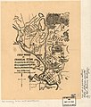
Battlefield in front of Franklin, Tenn., November 30th, 1864. LOC 2003630453.jpg 19,370 × 13,006; 29.04 MB
-
Battlefield in front of Franklin, Tenn., November 30th, 1864. LOC 2003630453.tif 19,370 × 13,006; 720.77 MB


