Category:1880s maps
| 19th-century maps: ← 1800s 1810s 1820s 1830s 1840s 1850s 1860s 1870s 1880s 1890s → |
Not to be confused with maps depicting the 1880s.
Subcategories
This category has the following 21 subcategories, out of 21 total.
Media in category "1880s maps"
The following 81 files are in this category, out of 81 total.
-
 1880 Abbott Map of Minneapolis.png 2,736 × 1,432; 1.87 MB
-
 1881-Shimane.jpg 1,063 × 826; 265 KB
-
 Breslau. (Village) NYPL1602993.tiff 5,428 × 7,230; 112.28 MB
-
 Danbury, Conn. (2675187021).jpg 2,000 × 1,118; 1.82 MB
-
 Datumsgrenze MK1888.png 337 × 458; 29 KB
-
 EB9 Connecticut.jpg 2,500 × 1,819; 2.18 MB
-
 Edinburgh in 1886 (2675181588).jpg 2,000 × 1,357; 2.15 MB
-
 Giurtelec.jpg 451 × 338; 60 KB
-
 Heisterburg Schuchhardt Gesamtplan.jpg 1,904 × 2,242; 1.1 MB
-
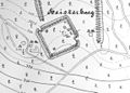 Heisterburg.jpg 1,152 × 827; 491 KB
-
 Karte Münchens Umgebung 1881.jpg 2,000 × 2,425; 1.63 MB
-
 Karte Oberamt Weinsberg.jpg 2,216 × 1,992; 1.29 MB
-
 Key - Location Map NYPL1957078.tiff 5,404 × 7,201, 2 pages; 111.4 MB
-
 Lake Powderhorn-1880 Abbott Map of Minneapolis 01.png 802 × 1,180; 1,014 KB
-
 Map of the New York Central & Hudson River and Boston & Albany Railroads (2674596070).jpg 2,000 × 1,631; 3.67 MB
-
 Meyers b1 s0142a.jpg 2,048 × 1,557; 803 KB
-
 Meyers b1 s0316a.jpg 2,350 × 1,450; 2.73 MB
-
 Meyers b1 s0328a.jpg 2,356 × 1,481; 3.1 MB
-
 Meyers b1 s0347a.jpg 2,048 × 1,687; 728 KB
-
 Meyers b1 s0394a.jpg 3,096 × 1,902; 1.24 MB
-
 Meyers b1 s0457b.jpg 1,460 × 2,048; 504 KB
-
 Meyers b1 s0457c.jpg 1,637 × 2,048; 659 KB
-
 Meyers b1 s0995a.jpg 2,260 × 1,380; 2.96 MB
-
 Meyers b10 s0662a.jpg 2,048 × 1,598; 779 KB
-
 Meyers b10 s0896a.jpg 2,048 × 1,594; 734 KB
-
 Meyers b10 s0905a.jpg 2,048 × 1,307; 746 KB
-
 Meyers b11 s0010a.jpg 2,460 × 1,675; 5.86 MB
-
 Meyers b11 s0058a.jpg 2,048 × 1,779; 842 KB
-
 Meyers b11 s0551a.jpg 2,350 × 1,472; 3.87 MB
-
 Meyers b11 s0553a.jpg 2,360 × 1,468; 4.19 MB
-
 Meyers b11 s0873a.jpg 2,048 × 1,680; 2.77 MB
-
 Meyers b12 s0227a.jpg 2,048 × 1,717; 716 KB
-
 Meyers b12 s0362a.jpg 1,619 × 2,048; 840 KB
-
 Meyers b12 s0499a.jpg 2,048 × 1,649; 822 KB
-
 Meyers b12 s0719a.jpg 2,048 × 1,622; 915 KB
-
 Meyers b12 s0719b.jpg 2,048 × 1,641; 836 KB
-
 Meyers b12 s0719c.jpg 2,048 × 1,339; 459 KB
-
 Meyers b12 s0865a.jpg 2,048 × 1,706; 851 KB
-
 Meyers b13 s0268a.jpg 1,642 × 2,048; 858 KB
-
 Meyers b13 s0781a.jpg 1,561 × 2,048; 815 KB
-
 Meyers b13 s0903a.jpg 2,048 × 1,657; 859 KB
-
 Meyers b13 s0940a.jpg 2,048 × 1,659; 596 KB
-
 Meyers b17 s0285a.jpg 3,217 × 2,470; 4.4 MB
-
 Meyers b3 s0525a.jpg 1,472 × 2,345; 3.84 MB
-
 Meyers b4 s0092a.jpg 3,558 × 2,232; 4.08 MB
-
 Meyers b4 s0801a.jpg 2,048 × 1,601; 874 KB
-
 Meyers b4 s0802a.jpg 2,048 × 1,632; 726 KB
-
 Meyers b4 s0812a.jpg 2,048 × 1,728; 573 KB
-
 Meyers b4 s0817a.jpg 2,048 × 1,724; 592 KB
-
 Meyers b4 s0851a.jpg 2,048 × 1,675; 653 KB
-
 Meyers b4 s0858a.jpg 2,048 × 1,677; 797 KB
-
 Meyers b4 s0870a.jpg 2,048 × 1,667; 776 KB
-
 Meyers b5 s0141a.jpg 2,048 × 2,558; 1.05 MB
-
 Meyers b5 s0146a.jpg 2,334 × 1,480; 3.71 MB
-
 Meyers b5 s0571a.jpg 2,048 × 2,680; 1.31 MB
-
 Meyers b5 s0775a.jpg 2,048 × 1,555; 647 KB
-
 Meyers b5 s0919a.jpg 2,048 × 1,529; 590 KB
-
 Meyers b5 s0919b.jpg 2,048 × 1,643; 633 KB
-
 Meyers b5 s0919c.jpg 2,048 × 1,648; 706 KB
-
 Meyers b6 s0508a.jpg 1,348 × 1,668; 3.16 MB
-
 Meyers b7 s0672a.jpg 2,048 × 1,664; 760 KB
-
 Meyers b7 s0696a.jpg 2,048 × 1,661; 913 KB
-
 Meyers b7 s0761a.jpg 1,632 × 2,048; 764 KB
-
 Meyers b8 s0022a.jpg 1,535 × 2,048; 705 KB
-
 Meyers b8 s0039a.jpg 3,096 × 1,721; 1.22 MB
-
 Meyers b9 s0201a.jpg 3,525 × 2,265; 5.23 MB
-
 Meyers b9 s0364a.jpg 2,309 × 3,569; 908 KB
-
 Meyers b9 s0550a.jpg 3,569 × 2,309; 6.68 MB
-
 Meyers b9 s0958a.jpg 3,569 × 2,309; 3.04 MB
-
 Stadtplan München 1885.jpg 7,517 × 4,629; 15.56 MB
-
 NansenGreenlandmap1888.jpg 546 × 850; 78 KB
-
 Penacook, N.H. (2675830552).jpg 2,000 × 1,342; 1.76 MB
-
 Plan of Erivan 1880s (Janovsky collection).jpg 600 × 527; 76 KB
-
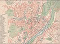
 Plan SPb 1885-1887.jpg 1,485 × 1,596; 989 KB
-
 PZSL1889Plate23.png 2,548 × 3,532; 8.37 MB
-
 Stadtplan München 1885 Variante2.jpg 5,697 × 4,719; 3.82 MB
-
 Stadtplan von München 1885 aus Malte-Brun.jpg 2,055 × 1,500; 725 KB
-
 TabulaPeutingeriana - Gensis.jpg 1,244 × 600; 631 KB
-
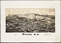 Wilton, N.H. (2675840130).jpg 2,000 × 1,433; 1.95 MB
-
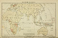
 Österreichische-Congo-Expedition-(1885-87).jpg 1,868 × 2,501; 4.73 MB
-
 Карта менонітських і єврейських поселень. 1880 р..png 737 × 585; 52 KB

.jpg)


.jpg)


.jpg)


.jpg)
.jpg)


.jpg)
.jpg)
