Category:1884 maps
| ← · 1880 · 1881 · 1882 · 1883 · 1884 · 1885 · 1886 · 1887 · 1888 · 1889 · → |
Deutsch: Karten mit Bezug zum Jahr 1884
English: Maps related to the year 1884
Español: Mapas relativos al año 1884
Français : Cartes concernant l’an 1884
Русский: Карты 1884 года
Subcategories
This category has the following 12 subcategories, out of 12 total.
*
A
E
G
N
O
S
Media in category "1884 maps"
The following 132 files are in this category, out of 132 total.
-
1846.Casernenstrasse 1 5.3068.tif 1,362 × 826; 4.31 MB
-
Hypsographical Map of Asia.jpg 2,498 × 1,937; 461 KB
-
CEDERBLAD(1884) Map of Göteborg.jpg 1,900 × 1,567; 1.43 MB
-
IMRAY(1884) p0006 CURVES OF EQUAL MAGNETIC VARTIATION, 1883.jpg 667 × 1,059; 511 KB
-
IMRAY(1884) p0069 FAYAL CHANEL.jpg 3,116 × 2,679; 3.75 MB
-
IMRAY(1884) p0069 HORTA BAY.jpg 3,138 × 2,657; 4.12 MB
-
IMRAY(1884) p0088 AZORES, PONTA DELGADA.jpg 1,601 × 2,631; 2.62 MB
-
IMRAY(1884) p0108 MADEIRA, FUNCHAL BAY.jpg 3,587 × 2,680; 5.45 MB
-
IMRAY(1884) p0129 SALVAGE ISLANDS.jpg 3,633 × 2,703; 3.57 MB
-
IMRAY(1884) p0140 SANTA CRUZ, TENERIFE.jpg 3,153 × 3,166; 4.98 MB
-
IMRAY(1884) p0154 LANZAROTE, ARRECIFE.jpg 3,178 × 2,994; 4.52 MB
-
IMRAY(1884) p0154 LANZAROTE, STRAIT OF RIO.jpg 3,160 × 2,374; 3.87 MB
-
IMRAY(1884) p0173 CAPE VERDES, PORTO GRANDE.jpg 1,603 × 2,664; 2.34 MB
-
IMRAY(1884) p0181 EASTERN SHOALS.jpg 3,137 × 2,189; 2.26 MB
-
IMRAY(1884) p0181 VIRGIN ROCKS.jpg 3,129 × 3,167; 2.9 MB
-
IMRAY(1884) p0187 SABLE ISLAND.jpg 1,591 × 2,677; 1.59 MB
-
IMRAY(1884) p0197 BERMUDA ISLANDS.jpg 1,585 × 2,669; 1.59 MB
-
IMRAY(1884) p0203 BERMUDA, THE NARROWS.jpg 3,607 × 2,813; 5.43 MB
-
IMRAY(1884) p0210 BAHAMAS, NASSAU.jpg 3,615 × 2,663; 5 MB
-
IMRAY(1884) p0225 VIRGIN ISLANDS, ST. THOMAS.jpg 3,595 × 2,715; 5.8 MB
-
IMRAY(1884) p0231 ROCKALL.jpg 981 × 852; 478 KB
-
IMRAY(1884) p0231 ST. PAUL ROCKS.jpg 1,587 × 1,359; 799 KB
-
IMRAY(1884) p0246 THE ROCAS.jpg 3,337 × 2,480; 2.75 MB
-
IMRAY(1884) p0261 ASCENSION.jpg 3,639 × 2,689; 4.82 MB
-
IMRAY(1884) p0273 ST.HELENA.jpg 3,633 × 2,697; 4.75 MB
-
IMRAY(1884) p0285 TRINIDAD.jpg 1,599 × 2,693; 1.95 MB
-
IMRAY(1884) p0293 TRISTAN DA CUNHA.jpg 3,647 × 2,703; 4.1 MB
-
IMRAY(1884) p0306 FALKLAND ISLANDS, STANLEY HARBOUR.jpg 3,631 × 2,699; 5.67 MB
-
IMRAY(1884) p0315 FALKLAND ISLANDS, BAY OF HARBOURS.jpg 1,623 × 2,687; 2.84 MB
-
IMRAY(1884) p0465 ENSENADA DE FINISTERRE.jpg 1,587 × 2,683; 2.3 MB
-
IMRAY(1884) p0575 LIBERIA, CAPE MOUNT RIVER.jpg 1,595 × 2,689; 2.34 MB
-
IMRAY(1884) p0707 TABLE BAY.jpg 1,606 × 2,679; 2.36 MB
-
IMRAY(1884) p0737 NEWFOUNDLAND, ST JOHN'S.jpg 1,619 × 2,663; 2.56 MB
-
IMRAY(1884) p0749 HALIFAX.jpg 1,603 × 2,639; 2.7 MB
-
IMRAY(1884) p0769 NEW YORK.jpg 3,631 × 2,643; 6.63 MB
-
IMRAY(1884) p0942 (1) WINDS IN THE ATLANTIC OCEAN.jpg 660 × 1,012; 469 KB
-
IMRAY(1884) p0947 (2) WINDS IN THE ATLANTIC OCEAN.jpg 655 × 1,010; 451 KB
-
IMRAY(1884) p0955 (3) WINDS IN THE ATLANTIC OCEAN.jpg 655 × 1,006; 453 KB
-
IMRAY(1884) p0961(4) WINDS IN THE ATLANTIC OCEAN.jpg 657 × 1,012; 504 KB
-
IMRAY(1884) p1007 Winds on the Coast of Brazil (1).jpg 717 × 949; 320 KB
-
IMRAY(1884) p1007 Winds on the Coast of Brazil (2).jpg 699 × 931; 323 KB
-
IMRAY(1884) p1007 Winds on the Coast of Brazil (3).jpg 731 × 965; 308 KB
-
IMRAY(1884) p1007 Winds on the Coast of Brazil (4).jpg 713 × 949; 284 KB
-
IMRAY(1884) p1020 WINDS AND WEATHER.jpg 933 × 390; 215 KB
-
IMRAY(1884) p1030 (6) Currents in the Atlantic Ocean.jpg 655 × 1,012; 484 KB
-
IMRAY(1884) p1060 (7) Basin of the Atlantic Ocean.jpg 659 × 1,009; 473 KB
-
IMRAY(1884) p1082 (8) HURKICANE AND STORM WINDS (1-2).jpg 486 × 950; 252 KB
-
IMRAY(1884) p1082 (8) HURKICANE AND STORM WINDS (3-4).jpg 524 × 956; 345 KB
-
IMRAY(1884) p1082 (8) HURKICANE AND STORM WINDS (5).jpg 884 × 897; 444 KB
-
IMRAY(1884) p1082 (8) HURKICANE AND STORM WINDS (6-7).jpg 615 × 917; 278 KB
-
IMRAY(1884) p1120 (10) Tracks in the Atlantic Ocean.jpg 655 × 1,013; 450 KB
-
(1884) CARTE NOUVELLE-CALEDONIE.jpg 2,535 × 3,259; 4.4 MB
-
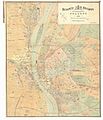
Budapest map 1884.jpg 10,157 × 11,797; 21.71 MB
-
Carte du département de l'Aube - 1884.jpg 8,927 × 7,104; 7.68 MB
-
Ceratiocaridæ from the upper Devonian measures in Warren County (1884) (20588554175).jpg 2,880 × 1,738; 1.31 MB
-
Chōsenkoku Kankyō-dō rojō sokuzu. Rigen-ken yori Kyōjōfu Yujō-eki ni itaru LOC 2008486372.tif 6,730 × 9,860; 189.85 MB
-
Chōsenkoku Kankyō-dō rojō sokuzu. Tokugen-fu yori Rigen-ken ni itaru LOC 2008486371.jpg 7,288 × 10,144; 9.32 MB
-
Chōsenkoku Kankyō-dō rojō sokuzu. Tokugen-fu yori Rigen-ken ni itaru LOC 2008486371.tif 7,288 × 10,144; 211.51 MB
-
Driving chart of Hartford and vicinity - 15 miles around. LOC 2012590164.jpg 12,413 × 12,512; 21.12 MB
-
Driving chart of Hartford and vicinity - 15 miles around. LOC 2012590164.tif 12,413 × 12,512; 444.35 MB
-
East Stroudsburg (2674305751).jpg 2,000 × 1,535; 2.24 MB
-
EB9 Nanking.png 2,498 × 2,092; 3.65 MB
-
EB9 Nevada.jpg 2,687 × 3,733; 1.79 MB
-
EB9 Newark.jpg 849 × 1,019; 524 KB
-
El puerto de Pajares por Ricardo Becerro.jpg 2,741 × 1,240; 433 KB
-
Expéditions de voyageurs et de marchandises.png 469 × 606; 556 KB
-
Gellért hegy térképe 1884.jpg 1,672 × 2,556; 580 KB
-
Großfriedrichsburg1884 Lage im Ort 300dpi.jpg 2,070 × 2,175; 684 KB
-
Halden map 1884.jpg 2,600 × 1,984; 5.84 MB
-
Hazleton (2674307151).jpg 2,000 × 1,596; 3.1 MB
-
Hedrich & Strauss Királymalma 1884-es térképen.jpg 869 × 738; 193 KB
-
Indian Ocean - Northern Portion RMG F3571.jpg 1,280 × 657; 225 KB
-
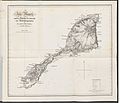
Jan Mayen map 1884 e-rara.jpg 7,168 × 6,144; 4.03 MB
-
Jan Mayen map 1884 Schritt2 sw als Palette.png 2,395 × 2,165; 1.33 MB
-
Jan Mayen map 1884 Schritt2 sw.png 2,395 × 2,165; 1.51 MB
-
Jan Mayen map 1884 Schritt2.png 2,395 × 2,165; 4.15 MB
-
Jan Mayen map 1884.jpg 2,395 × 2,165; 1.94 MB
-
The survey of Western Palestine-Jerusalem (1884) (14591905179).jpg 2,640 × 2,034; 315 KB
-
Karl Wolf, Aegyptus et Libya quae erant Romano potissimum tempore (FL32714056 3878283).jpg 7,411 × 6,249; 40.13 MB
-
Letts's historical & physical map of Ancient Pelestine (FL35084193 3891824).jpg 8,895 × 10,698; 140.54 MB
-
Ludovica Academy street map 1884.jpg 482 × 600; 222 KB
-
Map of San juan bautista (1884).jpg 4,257 × 3,069; 6.48 MB
-
Map of the Southern Express Company. LOC gm71000842.jpg 8,621 × 6,213; 9.53 MB
-
Map showing the Seaboard, Pennsylvania and Western Railroad and its connections. LOC 98688801.tif 9,036 × 7,792; 201.44 MB
-
MAPA DE CASTILLA LA VIEJA EN 1884.jpg 12,576 × 8,961; 21.76 MB
-
MIfflinburg (2674303005).jpg 2,000 × 1,555; 2.6 MB
-
Milano - Piano Beruto (bozza).jpg 1,200 × 1,458; 501 KB
-
MiskolcMap1884.jpg 4,876 × 3,411; 1.92 MB
-
Nagata hirakawa markiert.jpg 1,322 × 1,322; 186 KB
-
New General Map of the Asian-Eastern Provinces of the Ottoman Empire - Without Arabia.png 1,690 × 1,024; 3.15 MB
-
Northern Cheyenne Reservation (Tongue River Reservation) 1884.png 1,470 × 1,783; 5.41 MB
-
Nova acta Regiae Societatis Scientiarum Upsaliensis (1884) (14773635555).jpg 2,088 × 2,996; 898 KB
-
Népkert Miskolc Adler 1884.jpg 1,034 × 631; 232 KB
-
OACrailsheim-Karte.jpg 2,086 × 2,450; 770 KB
-
Panoramic view of Dayton, W.T., county seat of Columbia County 1884. LOC 75696657.jpg 8,400 × 4,816; 7.33 MB
-
Panoramic view of Dayton, W.T., county seat of Columbia County 1884. LOC 75696657.tif 8,400 × 4,816; 115.74 MB
-
Plan of the settlements at Chemulpo, 1884. LOC 2007631784.jpg 6,730 × 5,702; 4.99 MB
-
Plan of the settlements at Chemulpo, 1884. LOC 2007631784.tif 6,730 × 5,702; 109.79 MB
-
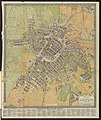
Plan von Leipzig 1884.jpg 6,587 × 7,811; 17.3 MB
-
Postal Map of Manitoba 1884.jpg 11,175 × 6,922; 18.44 MB
-
PSM V25 D379 Krakatoa before after eruption in august 1883.jpg 2,940 × 1,743; 430 KB
-
PSM V25 D513 Hot springs near bay of plenty new zealand.jpg 1,200 × 1,959; 264 KB
-
PSM V25 D519 Distribution of geysers and hot springs in yellowstone park.jpg 2,430 × 2,949; 644 KB
-
PSM V25 D612 Upper missouri river system.jpg 3,635 × 2,052; 506 KB
-
TE&II Vol 6 Fig 012.jpg 1,583 × 1,494; 171 KB
-
TE&II Vol 6 Fig 012b.jpg 1,346 × 616; 99 KB
-
The Auk (1884) (20355440431).jpg 1,354 × 3,162; 740 KB
-
Thomas Brumby Johnston, Palestine (FL63928746 3564717).jpg 3,840 × 5,760; 20.46 MB
-
Élisée Reclus, Jaffa (FL45585335 3928947).jpg 1,967 × 3,126; 2.23 MB
-
Élisée Reclus, Jérusalem (FL45585372 3928949).jpg 1,953 × 3,178; 2.33 MB


