Category:1880s maps of Denmark
Media in category "1880s maps of Denmark"
The following 16 files are in this category, out of 16 total.
-
Hadersleben.png 1,171 × 734; 1.99 MB
-
Koresandkarte1880w.jpg 600 × 499; 76 KB
-
Jütland geologisch.jpg 1,291 × 1,502; 1.17 MB
-
EB9 Norway & Sweden.jpg 1,827 × 2,636; 2.45 MB
-
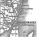
Karte der Umgebung von Kopenhagen.jpg 461 × 745; 97 KB
-
Kronborg location at Oresund in 1888.jpg 461 × 745; 138 KB
-
København1888 nu bygrænse.JPG 257 × 260; 27 KB
-
Meyers b4 s0500a.jpg 1,640 × 2,048; 1.96 MB
-
Sørvad-hoje-blade.png 1,500 × 1,500; 6.27 MB


