Category:1880s maps of Eritrea
Subcategories
This category has only the following subcategory.
C
- Carta della Colonia Eritrea (68 F)
Media in category "1880s maps of Eritrea"
The following 20 files are in this category, out of 20 total.
-
 Assab e il basso Mar Rosso.jpg 945 × 1,130; 190 KB
-
 Carta della baia d'Assab e regioni adiacenti (Torino, Guido Cora).jpg 945 × 775; 130 KB
-
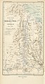
 DYE(1880) p519 Map of Northern Abyssinia.jpg 1,300 × 1,887; 1.31 MB
-
 Piano dello stabilimento italiano di Assab.jpg 1,559 × 1,522; 1.07 MB
-

-
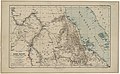
 UpperNubiaAndAbyssinia1891map.jpg 2,674 × 1,953; 2.69 MB
-
 Assab Bay (1885).jpg 1,977 × 1,965; 3.28 MB
-
-
 European territorial claims on the coasts of the Red Sea 1885.jpg 8,016 × 3,633; 23.98 MB
-
 European territorial claims on the coasts of the Red Sea 1885.tif 8,016 × 3,633; 27.9 MB
-
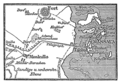 Meyers b11 s0322 b1.png 385 × 268; 50 KB
-
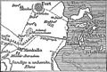 Situationskaertchen von Massaua.jpg 355 × 239; 32 KB
-
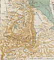 Map of Abissinia (1887) (cropped).jpg 1,817 × 2,046; 2.14 MB
-
 Map of Abissinia (1887).jpg 2,063 × 2,413; 2.77 MB
-
 Map of Massaua (1887).jpg 3,249 × 1,965; 2.99 MB
-

-
 Plano de la bahia de Assab (1887).jpg 3,716 × 4,880; 11.55 MB
-
 Plano de la bahía de Assab (español).jpg 3,721 × 4,864; 10.66 MB
-
-
 Reise durch das Baraka-Thal nach Kassala im März 1876.png 1,909 × 3,161; 9.03 MB

.jpg)
_p519_Map_of_Northern_Abyssinia.jpg)


.jpg)
.jpg)


_(cropped).jpg)
.jpg)
.jpg)

.jpg)
.jpg)
.jpg)
