Category:1880s maps of Sudan
Subcategories
This category has the following 3 subcategories, out of 3 total.
- 1884 maps of Sudan (8 F)
- 1887 maps of Sudan (10 F)
- 1889 maps of Sudan (5 F)
Media in category "1880s maps of Sudan"
The following 21 files are in this category, out of 21 total.
-

-
 UpperNubiaAndAbyssinia1891map.jpg 2,674 × 1,953; 2.69 MB
-
-

-
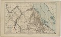
 Cassell's history of the war in the Soudan (1885) (14597430259).jpg 2,272 × 1,806; 530 KB
-
 Egypt and the basin of the Nile (2674836051).jpg 1,692 × 2,000; 2.94 MB
-
 Mahdi 1885.png 333 × 600; 418 KB
-
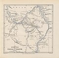
 Northeast Africa 1885.jpg 860 × 779; 240 KB
-

-
-

-

-

-
-

-
 Egypte, Soudan, Abyssinie - btv1b53021204q.jpg 6,826 × 8,865; 6.76 MB
-
 Joseph Menges Reisen zwischen Kassala und dem Setit.png 1,907 × 2,304; 5.94 MB
-
 Map of the Nile districs between Assouan & Khartoom.png 7,051 × 9,516; 138.89 MB
-
 Map of the Nile provinces from the Third Cataract (Hannek) to Khartum.png 10,146 × 7,471; 79.63 MB
-
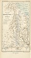
 The earth and its inhabitants (1886) (21134117881).jpg 1,434 × 1,954; 553 KB
-
 Tofrek Zeriba Map.jpg 1,076 × 1,451; 275 KB


.jpg)

_(14597430259).jpg)
.jpg)


.jpg)
.jpg)
.jpg)
.jpg)
.jpg)
.jpg)


_to_Khartum.png)
_(21134117881).jpg)
