Category:1880s maps of Palestine
Countries of Asia: Afghanistan · Armenia‡ · Azerbaijan‡ · People's Republic of China · Cyprus‡ · Egypt‡ · Georgia‡ · India · Indonesia‡ · Iran · Iraq · Japan · Jordan · Lebanon · Pakistan · Philippines · Russia‡ · Syria · Turkey‡ · Turkmenistan · Uzbekistan · Yemen
Limited recognition: Abkhazia‡ · Taiwan · State of Palestine
‡: partly located in Asia
Limited recognition: Abkhazia‡ · Taiwan · State of Palestine
‡: partly located in Asia
Subcategories
This category has the following 3 subcategories, out of 3 total.
Media in category "1880s maps of Palestine"
The following 44 files are in this category, out of 44 total.
-
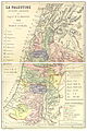 (1881) LA PALESTINE.jpg 1,980 × 2,977; 2.42 MB
-
 Khan-al-Tujar-plan-PEF-c1881-1.jpg 865 × 1,065; 68 KB
-

-

-
 Masada (Conder 02).jpg 934 × 1,203; 719 KB
-
 Mountseirsinaiwe00hull Page 214.png 1,365 × 1,920; 370 KB
-
 Palestine, or, the Holy Land ; Persia, Afghanistan and Beluchistan. LOC 2006627700.jpg 6,110 × 8,335; 10.97 MB
-
 Palestine, or, the Holy Land ; Persia, Afghanistan and Beluchistan. LOC 2006627700.tif 6,110 × 8,335; 145.7 MB
-
 Palestine, or, the Holy Land; Persia, Afghanistan and Beluchistan WDL12989.png 1,024 × 1,396; 3.22 MB
-
 SchumacherElHamma.png 2,000 × 1,791; 495 KB
-

-

-
 A dictionary of the Bible.. (1887) (14781750285).jpg 1,848 × 1,928; 645 KB
-
 A dictionary of the Bible.. (1887) (14801566933).jpg 1,328 × 1,812; 622 KB
-
 A dictionary of the Bible.. (1887) (14595031370).jpg 1,720 × 2,708; 1.02 MB
-
 A dictionary of the Bible.. (1887) (14595085170).jpg 3,096 × 1,904; 802 KB
-
 A dictionary of the Bible.. (1887) (14595233939).jpg 1,984 × 3,240; 962 KB
-
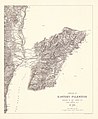
 Eastern Jaulan and Western Hauran, 1888.jpg 7,087 × 4,676; 4.41 MB
-

-
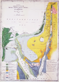
 1889 Palestine, geological.jpg 1,727 × 2,934; 2.71 MB
-
 1889 Palestine, physical.jpg 1,747 × 2,959; 3.24 MB
-

-
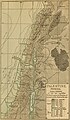 Palestine (1889 book) 28.jpg 1,690 × 2,886; 914 KB
-
 Palestine (1889 book) 29.jpg 1,662 × 2,863; 703 KB
-
 Palestine (1889 book) 33.jpg 1,698 × 2,886; 535 KB
-
 1889 Palestine by Conder.jpg 2,082 × 2,534; 3.83 MB
-
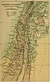
 1889 Modern Palestine, shewing Turkish provinces.jpg 1,743 × 2,926; 2.86 MB
-

-

-
 Diunot zal.jpg 656 × 1,008; 171 KB
-
 Gottlieb Schumacher, Lake of Hooleh (Water of Merom) (FL45611039 3950393).jpg 913 × 1,484; 1.39 MB
-
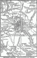 Historische Karte von der Umgebung Jerusalem MK1888.png 369 × 580; 59 KB
-
 Image from page 230 of "A dictionary of the Bible.." (1887) (14595154277).jpg 1,848 × 1,228; 323 KB
-
 Karta egypten gamla tiden.jpg 1,767 × 1,282; 803 KB
-
 Meyers b12 s0618a.jpg 1,647 × 2,048; 762 KB
-
 Mountseirsinaiwe00hull Page 236.png 1,848 × 2,546; 3.64 MB
-
 Palestine (1889 book) 02.jpg 2,181 × 2,749; 897 KB
-
 Palestine, Ptolemy, Claude R Conder, 1889.jpg 824 × 817; 126 KB
-
 PEF Survey of Eastern Palestine.jpg 5,372 × 6,542; 10.95 MB
-
 Plan of Sussita by Gottlieb Schumacher 1885.jpg 1,947 × 2,037; 1.52 MB
-
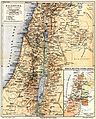
 Sketch map of Palestine. LOC 2005625225.jpg 2,617 × 3,764; 1.07 MB
-
 Sketch map of Palestine. LOC 2005625225.tif 2,617 × 3,764; 28.18 MB
-
 The journeys, and deeds of Jesus, and scriptoral index on a new map of Palestine LOC 2009579464.jpg 8,975 × 12,631; 14.06 MB
-
 חיספין במפה של גוטליב שומאכר מ-1885.jpg 461 × 405; 70 KB
_LA_PALESTINE.jpg)

.jpg)
.jpg)


%27_(11182396045).jpg)
.jpg)
_(14781750285).jpg)
_(14801566933).jpg)
_(14595031370).jpg)
_(14595085170).jpg)
_(14595233939).jpg)

.jpg)


%27_(11201044884).jpg)
_28.jpg)
_29.jpg)
_33.jpg)


.jpg)
%27_(11174603615).jpg)

_(FL45611039_3950393).jpg)

_(14595154277).jpg)


_02.jpg)


.jpg)