Category:1830s maps of Palestine
Countries of Asia: Afghanistan · Armenia‡ · Azerbaijan‡ · People's Republic of China · Cyprus‡ · Egypt‡ · Georgia‡ · India · Indonesia‡ · Iran · Iraq · Japan · Jordan · Lebanon · Pakistan · Philippines · Russia‡ · Syria · Turkey‡ · Uzbekistan
Limited recognition: Abkhazia‡ · Taiwan · State of Palestine
‡: partly located in Asia
Limited recognition: Abkhazia‡ · Taiwan · State of Palestine
‡: partly located in Asia
Media in category "1830s maps of Palestine"
The following 12 files are in this category, out of 12 total.
-

-
 Daniel Lizars. Turkey in Asia. 1831 (K).jpg 1,097 × 981; 277 KB
-
 Karte von Syrien. den Manen Jacotin's und Burckhardt's gewidmet. von H. Berghaus.jpg 9,647 × 13,939; 23.6 MB
-
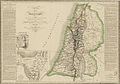
 1836 Tanner Map of Palestine - Israel - Holy Land - Geographicus - Palestine-tanner-1836.jpg 3,256 × 4,000; 2.19 MB
-

-
 Aegyptus et Palaestina - DPLA - f9140cee451999fc85fb12c199b0b357.jpg 777 × 1,000; 249 KB
-
 Karte von dem Gelobten Lande und der 40-jährigen Reise der Kinder Israel.jpg 5,582 × 3,916; 5.75 MB
-
 Moshe Ganbash - Shiviti - Google Art Project.jpg 4,121 × 3,338; 7.68 MB
-
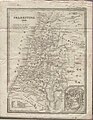 Palaestina 1832 (FL45602881 3938454).jpg 2,594 × 3,334; 4.03 MB
-
 Ritter Palestine map 1830.jpg 4,427 × 6,460; 5.87 MB
-
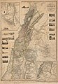
 Sidney Hall 1830 map of Palestine showing Ottoman divisions.jpg 5,310 × 6,488; 6.14 MB
-
 Toussaint, A. Carte de la Palestine. 1834.jpg 8,590 × 5,987; 7.18 MB
.jpg)
.jpg)


.jpg)


.jpg)


