Category:1900s maps of Palestine
Countries of Asia: Afghanistan · Armenia‡ · Azerbaijan‡ · People's Republic of China · Cyprus‡ · Egypt‡ · Georgia‡ · India · Indonesia‡ · Iran · Iraq · Japan · Jordan · Lebanon · Pakistan · Philippines · Russia‡ · Syria · Thailand · Turkey‡ · Uzbekistan
Limited recognition: Abkhazia‡ · Taiwan · State of Palestine
‡: partly located in Asia
Limited recognition: Abkhazia‡ · Taiwan · State of Palestine
‡: partly located in Asia
Media in category "1900s maps of Palestine"
The following 27 files are in this category, out of 27 total.
-
 The Euphrates Valley - Syria, Kurdistan, etc. LOC 2013593032.tif 8,752 × 5,468; 136.92 MB
-
 Map page from Hók Ĭng Sṳ̄ Gé Sṳ̆ Dĭ Gúong ék.jpg 2,665 × 3,793; 2.6 MB
-
 Jerusalem area map 1903.jpg 491 × 628; 270 KB
-
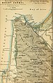
 Nablus area map 1903.jpg 390 × 635; 191 KB
-
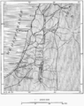
 Sea of galilee map 1903.jpg 596 × 655; 278 KB
-
 Sea of galilee map 1903closeup.jpg 5,120 × 3,000; 1.49 MB
-
 D067-Palestine-L2-Ch5.png 1,518 × 1,892; 414 KB
-
 D068- N° 436. Egypte et Syrie de Bonaparte. - Liv3-Ch16.png 1,444 × 1,798; 336 KB
-
 D089-Routes et Villes de la Palestine.-L2-Ch5.png 1,512 × 1,904; 696 KB
-
 D093-Jérusalem et la Mer Morte.-L2-Ch5.png 1,514 × 1,552; 621 KB
-
 No 120. Plaine d'Esdrealon. 1905-1905.jpg 1,885 × 1,918; 920 KB
-

-
 Bedouin map.jpg 483 × 746; 250 KB
-
 The Harmsworth atlas and Gazetter 1908 (135850138).jpg 12,561 × 9,578; 123.36 MB
-
 Egypt Ottoman border 1906.jpg 578 × 1,247; 147 KB
-
 Gottlieb Schumacher. Karte des Ostjordanlandes Blatt I. 1900.jpg 1,024 × 1,200; 249 KB
-
-
 Map from Hók Ĭng Sṳ̄ Gé Sṳ̆ Dĭ Gúong ék original color.png 1,469 × 2,304; 6.34 MB
-
 Map from Hók Ĭng Sṳ̄ Gé Sṳ̆ Dĭ Gúong ék white and black.jpg 1,469 × 2,304; 699 KB
-
 Map of the Jerusalem Sanjak.jpg 571 × 1,006; 95 KB
-
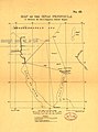 Map of the Sinai peninsula to illustrate the Turco-Egyptian frontier dispute.jpg 818 × 1,104; 111 KB
-
 Map showing Turco-Egyptian Boundrary of 1st October 1906.jpg 859 × 1,567; 162 KB
-
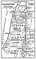 Maury Geography 122D Palestine.jpg 484 × 798; 92 KB
-
 Nr. 5. Acht Karten zur Geschichte Palaestinas.png 4,220 × 3,308; 39.97 MB
-
-
 Routes et Villes de la Palestine. 1905-1905.jpg 1,870 × 2,365; 1.34 MB
-
 Tribus des Juifs et Peuples avoisinants. 1905-1905.jpg 1,864 × 2,385; 1.06 MB


_(14586920148).jpg)

.jpg)


_(14782272324).jpg)


_(14781457971).jpg)

