Category:1900s maps of Georgia
Countries of Europe: Albania · Armenia‡ · Azerbaijan‡ · Belarus · Belgium · Bosnia and Herzegovina · Bulgaria · Croatia · Cyprus‡ · Czech Republic · Denmark · Finland · France‡ · Georgia‡ · Germany · Greece · Hungary · Iceland · Republic of Ireland · Italy · Lithuania · Netherlands‡ · Norway · Poland · Portugal‡ · Romania · Russia‡ · Serbia · Slovakia · Spain‡ · Sweden · Switzerland · Turkey‡ · Ukraine · United Kingdom
Limited recognition: Abkhazia‡
‡: partly located in Europe
Limited recognition: Abkhazia‡
‡: partly located in Europe
Subcategories
This category has the following 5 subcategories, out of 5 total.
- 1900 maps of Georgia (1 F)
- 1901 maps of Georgia (1 F)
-
Media in category "1900s maps of Georgia"
The following 13 files are in this category, out of 13 total.
-
 Stanford, Edward. Asia Minor, Caucasus, Black Sea. 1901 (D).jpg 852 × 527; 208 KB
-
 Осада Ахалцыха (1828).jpg 4,061 × 1,661; 1.85 MB
-
 Stanford, Edward. Asia Minor, Caucasus, Black Sea. 1901 (X).jpg 1,115 × 793; 357 KB
-
 Akhalkalaki earthquake map.png 2,469 × 3,177; 15.7 MB
-
 Carte de La « Riviera » Russe.jpg 337 × 366; 41 KB
-
 Georgien BV044856367.jpg 4,000 × 4,259; 6.85 MB
-
 Caucasus map (in Russian, 1903).jpg 11,831 × 8,482; 20.08 MB
-

-
 Kaukasuslander - Caucasus in the Russian Empire (1905).jpg 6,777 × 4,235; 11.79 MB
-
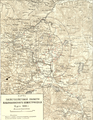
 Map of Kutaisi Governorate.jpg 405 × 374; 64 KB
-
 Map-1903-caucasus.jpg 17,694 × 11,940; 44.8 MB
-
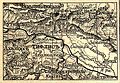 Tiflis governorate map.jpg 405 × 279; 54 KB
-
 Кавказ.jpg 1,034 × 1,097; 409 KB
.jpg)
.jpg)


.jpg)
.jpg)
.jpg)


.jpg)