Category:1900s maps of Italy
Countries of Europe: Albania · Armenia‡ · Azerbaijan‡ · Belarus · Belgium · Bosnia and Herzegovina · Bulgaria · Croatia · Cyprus‡ · Czech Republic · Denmark · Finland · France‡ · Georgia‡ · Germany · Greece · Hungary · Iceland · Republic of Ireland · Italy · Lithuania · Netherlands‡ · Norway · Poland · Portugal‡ · Romania · Russia‡ · Serbia · Slovakia · Spain‡ · Sweden · Switzerland · Turkey‡ · Ukraine · United Kingdom
Limited recognition: Abkhazia‡
‡: partly located in Europe
Limited recognition: Abkhazia‡
‡: partly located in Europe
Subcategories
This category has the following 7 subcategories, out of 7 total.
- 1909 maps of Italy (5 F)
.
- 1900s maps of Liguria (20 F)
Media in category "1900s maps of Italy"
The following 11 files are in this category, out of 11 total.
-
 Map of Italy - 1905.jpg 1,480 × 2,007; 1.86 MB
-
 The Harmsworth atlas and Gazetter 1908 (135849503).jpg 9,574 × 12,565; 119.76 MB
-
 The Harmsworth atlas and Gazetter 1908 (135849544).jpg 12,575 × 9,568; 131.57 MB
-
 The Harmsworth atlas and Gazetter 1908 (135849582).jpg 12,436 × 9,568; 124.33 MB
-

-
 Avezzano carta 1907.jpg 1,595 × 2,248; 2.72 MB
-
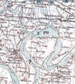 Isola Serafini 1907.png 644 × 725; 304 KB
-
 Italy (1907) (14764224574).jpg 1,882 × 2,046; 364 KB
-
 Italy 1900.jpg 1,276 × 1,590; 267 KB
-

-
 The spell of Italy (1909) (14781799904).jpg 1,478 × 1,872; 251 KB

.jpg)
.jpg)
.jpg)
_(14592326230).jpg)


_(14764224574).jpg)

_(14763423445).jpg)
_(14781799904).jpg)