Category:1890s maps of Italy
Subcategories
This category has the following 11 subcategories, out of 11 total.
- 1890 maps of Italy (7 F)
- 1891 maps of Italy (7 F)
- 1893 maps of Italy (12 F)
- 1894 maps of Italy (1 F)
- 1896 maps of Italy (3 F)
- 1897 maps of Italy (1 F)
- 1898 maps of Italy (24 F)
.
Media in category "1890s maps of Italy"
The following 28 files are in this category, out of 28 total.
-
 10 of 'Autour de la Méditerranée ... Illustrations par A. Chapon, etc' (11216835824).jpg 2,028 × 2,823; 2.11 MB
-

-

-
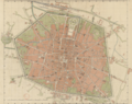 Pianta della Città di Bologna - ritaglio.png 7,910 × 6,259; 68.35 MB
-

-
 69 of '(Longmans' Junior School Geography, etc.)' (11210256506).jpg 2,001 × 2,706; 1.12 MB
-

-
 238 of '(Italy and her Invaders, Vol. 1-4.)' (11216808023).jpg 2,560 × 3,249; 1.52 MB
-
 151 of 'Leerboek der Aardsrijkskunde. Met Schetskaartjes, etc' (11302167233).jpg 1,195 × 1,291; 287 KB
-

-

-

-

-
 30 of 'A Pilgrimage to Italy, etc' (11251646375).jpg 1,415 × 2,297; 1,001 KB
-
 266 of 'L'Italia geografica illustrata, etc' (11208912514).jpg 3,318 × 2,192; 1.94 MB
-
 288 of 'Pitman's Commercial Geography of the World' (11247214333).jpg 1,351 × 1,942; 854 KB
-

-

-

-

-

-
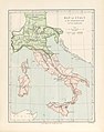
 Map of Italy.jpg 2,935 × 3,521; 2.26 MB
-
 Nouveau Larousse illustré - dictionnaire universel encyclopédique (1898) (14801618003).jpg 2,362 × 3,360; 1.25 MB
-
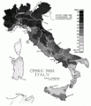
 PSM V51 D741 Physical geography of italy.png 2,286 × 2,405; 497 KB
-
 PSM V51 D742 Cephalic index of italy.png 2,227 × 2,589; 489 KB
-
 PSM V51 D745 Relative frequency of brunet traits.png 2,247 × 2,563; 465 KB
-
 PSM V51 D746 Relative frequency of tall statures.png 2,234 × 2,556; 481 KB
-

.jpg)
_oszt%C3%A1ly_sz%C3%A1mara._(With_maps.)%27_(11205744436).jpg)
.jpg)

%27_(11212408485).jpg)
%27_(11210256506).jpg)
.jpg)
%27_(11216808023).jpg)
.jpg)
.jpg)
%27_(11232971493).jpg)
.jpg)
.jpg)
.jpg)
.jpg)
.jpg)
%27_(11210402556).jpg)
.jpg)
.jpg)
.jpg)
.jpg)

_(14801618003).jpg)


_(14785625823).jpg)