Category:1810s maps of Italy
Countries of Europe: Albania · Armenia‡ · Austria · Azerbaijan‡ · Belgium · Bosnia and Herzegovina · Bulgaria · Croatia · Cyprus‡ · Czech Republic · Denmark · Finland · France‡ · Georgia‡ · Germany · Greece · Hungary · Republic of Ireland · Italy · Lithuania · Netherlands‡ · Norway · Poland · Portugal‡ · Romania · Russia‡ · Slovakia · Slovenia · Spain‡ · Sweden · Turkey‡ · Ukraine · United Kingdom
Limited recognition: Abkhazia‡
‡: partly located in Europe
Limited recognition: Abkhazia‡
‡: partly located in Europe
- Regions of Italy: Emilia-Romagna · Lazio · Liguria · Lombardy · Marche · Trentino-South Tyrol · Tuscany · Umbria ·
Subcategories
This category has the following 14 subcategories, out of 14 total.
- 1813 maps of Italy (1 F)
.
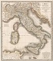
Media in category "1810s maps of Italy"
The following 4 files are in this category, out of 4 total.
-

-
 1810 map of Northern Italy.jpg 15,572 × 12,177; 40.55 MB
-
 Italy, 1815 (Wyld).jpg 7,077 × 8,112; 9.39 MB
-
 Upravni zemljevid Ilirskega kraljestva leta 1817.jpg 7,365 × 9,760; 9.56 MB
_(With_portraits.)%27_(11004684926).jpg)

.jpg)
