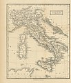
Category:1870s maps of Italy
Countries of Europe: Armenia‡ · Austria · Azerbaijan‡ · Belgium · Bosnia and Herzegovina · Bulgaria · Croatia · Cyprus‡ · Czech Republic · Denmark · Finland · France‡ · Georgia‡ · Germany · Greece · Hungary · Republic of Ireland · Italy · Latvia · Lithuania · Luxembourg · Netherlands‡ · Norway · Poland · Portugal‡ · Romania · Russia‡ · Serbia · Slovenia · Spain‡ · Sweden · Switzerland · Turkey‡ · Ukraine · United Kingdom
Limited recognition: Abkhazia‡
‡: partly located in Europe
Limited recognition: Abkhazia‡
‡: partly located in Europe
Subcategories
This category has the following 10 subcategories, out of 10 total.
- 1872 maps of Italy (3 F)
- 1873 maps of Italy (2 F)
- 1878 maps of Italy (3 F)
.
- 1870s maps of Liguria (5 F)
Media in category "1870s maps of Italy"
The following 15 files are in this category, out of 15 total.
-

-

-

-

-

-
-
-

-

-

-
-

-

-

-
 Lago Fucino 1875.jpg 3,581 × 2,334; 763 KB
%27_(11246892775).jpg)
%27_(11247588085).jpg)
.jpg)
.jpg)
%27_(11259764773).jpg)
%27_(11257570584).jpg)
_With_numerous_maps_and_notes%27_(11108682884).jpg)
_With_numerous_maps_and_notes%27_(11109897454).jpg)
.jpg)
.jpg)
%27_(11126621125).jpg)
.jpg)
_With_numerous_maps_and_notes%27_(11109267005).jpg)
.jpg)
