Category:1870s maps of Switzerland
Countries of Europe: Armenia‡ · Austria · Azerbaijan‡ · Belgium · Bosnia and Herzegovina · Bulgaria · Croatia · Cyprus‡ · Czech Republic · Denmark · Finland · France‡ · Georgia‡ · Germany · Greece · Hungary · Republic of Ireland · Italy · Latvia · Lithuania · Luxembourg · Netherlands‡ · Norway · Poland · Portugal‡ · Romania · Russia‡ · Serbia · Slovenia · Spain‡ · Sweden · Switzerland · Turkey‡ · Ukraine · United Kingdom
Limited recognition: Abkhazia‡
‡: partly located in Europe
Limited recognition: Abkhazia‡
‡: partly located in Europe
Subcategories
This category has the following 12 subcategories, out of 12 total.
- 1870 maps of Switzerland (6 F)
- 1871 maps of Switzerland (2 F)
- 1872 maps of Switzerland (2 F)
- 1873 maps of Switzerland (3 F)
- 1874 maps of Switzerland (9 F)
- 1876 maps of Switzerland (1 F)
- 1878 maps of Switzerland (4 F)
- 1879 maps of Switzerland (3 F)
1
- Atlas der Alpenländer, 1874 (13 F)
Media in category "1870s maps of Switzerland"
The following 27 files are in this category, out of 27 total.
-
-
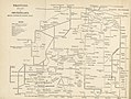
 Vierteljahrsschrift der Naturforschenden Gesellschaft in Zürich (1872) (14784971065).jpg 3,634 × 1,827; 848 KB
-

-
-
-

-

-

-

-

-

-

-
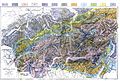 Map of the Central Alps gelogical 1876.jpg 6,476 × 4,370; 10.73 MB
-
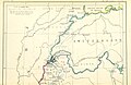
 The Collegiate Atlas 1876 (82450973).jpg 8,367 × 6,671; 7.74 MB
-

-

-

-

-

-

-

-
 Karte des Ober Engadin - Aus J. M. Ziegler - btv1b84602680.jpg 9,355 × 8,316; 17.26 MB
-

-
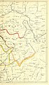
 Siegfriedkarte 529 Orsières 1878.png 605 × 433; 667 KB
-
 Fribourg Siegfriedkarte 1874.jpg 1,500 × 1,125; 533 KB
-
 In dreissig Tagen durch die Schweiz1.jpg 5,029 × 3,996; 2.99 MB
-
 Paluegletscher 1877 Siegfriedkarte.jpg 1,449 × 1,206; 1.41 MB
%27_(11111213763).jpg)
_(14784971065).jpg)
_With_numerous_maps_and_notes%27_(11109370225).jpg)
_With_numerous_maps_and_notes%27_(11108682884).jpg)
_With_numerous_maps_and_notes%27_(11110554646).jpg)
_With_numerous_maps_and_notes%27_(11108290306).jpg)
%27_(11112532444).jpg)
%27_(11112980065).jpg)
.jpg)
.jpg)
.jpg)

.jpg)
.jpg)
.jpg)
.jpg)
.jpg)
.jpg)
.jpg)
.jpg)


%27_(11067112263).jpg)