Category:1890s maps of Ukraine
Countries of Europe: Albania · Armenia‡ · Austria · Azerbaijan‡ · Belarus · Belgium · Bosnia and Herzegovina · Bulgaria · Croatia · Cyprus‡ · Czech Republic · Denmark · Estonia · Finland · France‡ · Georgia‡ · Germany · Greece · Hungary · Iceland · Republic of Ireland · Italy · Latvia · Lithuania · Montenegro · Netherlands‡ · Norway · Poland · Portugal‡ · Romania · Russia‡ · Serbia · Slovakia · Slovenia · Spain‡ · Sweden · Switzerland · Turkey‡ · Ukraine · United Kingdom
Limited recognition: Abkhazia‡
‡: partly located in Europe
Limited recognition: Abkhazia‡
‡: partly located in Europe
Media in category "1890s maps of Ukraine"
The following 17 files are in this category, out of 17 total.
-
 Czernobyl - 48-51.jpg 3,225 × 5,033; 2.52 MB
-
 Kiev-map-1894-1.jpg 2,691 × 1,846; 1.04 MB
-
 Plan goroda Odessy LOC 2014592004.jpg 12,079 × 7,718; 17.91 MB
-
 Plan goroda Odessy LOC 2014592004.tif 12,079 × 7,718; 266.72 MB
-

-
 Dnepr-porohy.jpeg 234 × 757; 52 KB
-
 Karta Ukrainskikh zemelʹ, 44 mīloniv naseleni︠a︡ nakladom LCCN2012650043.jpg 1,024 × 663; 412 KB
-
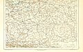
 Map of Kharkov (1896).jpg 2,000 × 1,442; 433 KB
-

-
-
-
 Artasów Kulików Udnów 1898.jpg 746 × 556; 140 KB
-
 Хабарище на гідрографічній карті Полісся 1898 року.jpg 2,150 × 962; 689 KB
-
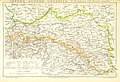
 Europe roumanophone en 1896 - The Time Atlas.jpg 749 × 924; 784 KB
-
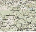 Gurby.jpg 645 × 573; 116 KB
-
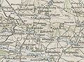
 Map of Kherson in XIX century.jpg 780 × 572; 139 KB
-
 Хабарище на карті трьохверстівці XIX століття.jpg 3,229 × 1,790; 1.33 MB


.jpg)
%27_(11244667554).jpg)
%27_(11248440585).jpg)
%27_(11247452714).jpg)


