Category:1900s maps of India
Countries of Asia: Afghanistan · Armenia‡ · Azerbaijan‡ · People's Republic of China · Cyprus‡ · Egypt‡ · Georgia‡ · India · Indonesia‡ · Iran · Iraq · Japan · Jordan · Lebanon · Pakistan · Philippines · Russia‡ · Syria · Thailand · Turkey‡ · Uzbekistan
Limited recognition: Abkhazia‡ · Taiwan · State of Palestine
‡: partly located in Asia
Limited recognition: Abkhazia‡ · Taiwan · State of Palestine
‡: partly located in Asia
Subcategories
This category has the following 7 subcategories, out of 7 total.
- 1903 maps of India (10 F)
- 1904 maps of India (3 F)
- 1905 maps of India (20 F)
- 1907 maps of India (16 F)
- 1908 maps of India (15 F)
- 1909 maps of India (38 F)
Media in category "1900s maps of India"
The following 20 files are in this category, out of 20 total.
-
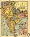
 India 1900.jpg 1,276 × 1,769; 336 KB
-
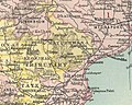
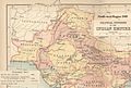
 Hderabad State 1901.jpg 1,512 × 1,034; 612 KB
-
 Hyderabad State 1901.jpg 1,512 × 1,034; 588 KB
-
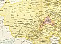
 Mayurbhanj State 1901.jpg 488 × 390; 301 KB
-

-
 Inde.jpg 1,024 × 1,251; 2.65 MB
-
 Map of the ruins of Patliputra by L.A. Waddell Published in 1903.jpg 2,790 × 2,485; 571 KB
-

-

-
 India in 1398 Joppen.jpg 2,043 × 2,877; 1.7 MB
-
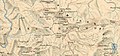 Changchenmo-Valley-map-Survey-of-India-1916.jpg 1,518 × 703; 436 KB
-
 East India Empire Map.jpg 1,498 × 1,222; 1.59 MB
-
 EndreiZ11.jpg 1,696 × 2,676; 2.91 MB
-
 India Vegetation Features IGI 1909 Atlas.jpg 6,141 × 5,063; 8.96 MB
-
 India WDL388.png 1,024 × 1,251; 2.81 MB
-
 India. LOC 98687195.jpg 2,934 × 3,586; 2.8 MB
-
 India. LOC 98687195.tif 2,934 × 3,586; 30.1 MB
-
 Jodhpur-map.jpg 844 × 607; 133 KB
-
 KB!05 - black-white map of India.png 3,688 × 3,168; 268 KB
-
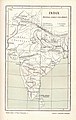
 NWBritish Indian Empire1909.jpg 1,327 × 900; 267 KB


.jpg)


_(14804421613).jpg)


