Category:1900s maps of the Philippines
- Provinces of the Philippines
- Province-level divisions (independent cities, Metro Manila)
Subcategories
This category has the following 2 subcategories, out of 2 total.
Media in category "1900s maps of the Philippines"
The following 17 files are in this category, out of 17 total.
-
 A complete geography (1902) (14766772624).jpg 2,400 × 1,662; 799 KB
-
 The new international encyclopaedia (1905) (14595414437).jpg 1,872 × 2,274; 588 KB
-
 Map of the Philippine Islands. LOC 2014589783.jpg 3,348 × 4,815; 2.22 MB
-
 Map of the Philippine Islands. LOC 2014589783.tif 3,348 × 4,815; 46.12 MB
-
 The Harmsworth atlas and Gazetter 1908 (135850349).jpg 12,497 × 9,570; 117.82 MB
-

-
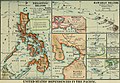
 Earthquake map of the Philippines, 1862-1909.jpg 3,000 × 4,068; 772 KB
-
 Location of troops in the Philippine Islands, March 31, 1900 LOC 2012586634.jpg 6,528 × 8,954; 4.87 MB
-
 Location of troops in the Philippine Islands, March 31, 1900 LOC 2012586634.tif 6,528 × 8,954; 167.23 MB
-
 Map of Lanao (c. 1900, Philippines).gif 1,626 × 2,075; 583 KB
-
 Map of the Philippine Islands LOC 2013590196.jpg 12,474 × 17,167; 31.49 MB
-
 Map of the Philippine Islands LOC 2013590196.tif 12,474 × 17,167; 612.66 MB
-
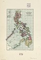
 Map of the Philippines (1900).gif 1,431 × 2,091; 218 KB
-
 Map of the Philippines 2 (1900).jpg 566 × 720; 90 KB
-
 NIE 1905 Luzon.jpg 1,740 × 2,221; 1.37 MB
-
 NIE 1905 Philippine Islands - map.jpg 1,768 × 2,144; 939 KB
-
 Philippine life in town and country (1905) (14582242179).jpg 2,244 × 2,984; 1.06 MB
_(14766772624).jpg)
_(14595414437).jpg)

.jpg)
_(14804446703).jpg)


.gif)

.gif)
.jpg)


_(14582242179).jpg)