Category:1881 maps of California
States of the United States: California · Connecticut · Idaho · Iowa · Louisiana · Maryland · Massachusetts · Michigan · New Mexico · New York · Pennsylvania · South Dakota · Texas · Utah · Washington · Wyoming
| ← 1880 1881 1883 1884 1885 1886 1887 1888 1889 → |
Media in category "1881 maps of California"
The following 5 files are in this category, out of 5 total.
-
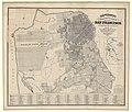
 12th Lighthouse District Map.jpg 1,086 × 1,400; 191 KB
-
 1881 Mitchell Map of California w- San Francisco Inset - Geographicus - CA-m-1881.jpg 2,363 × 3,500; 2.24 MB
-
-
 Map of the Military Department of California - NARA - 122206824.jpg 9,000 × 10,178; 7.1 MB
-
 Map of the Military Department of California - NARA - 23812143.jpg 9,024 × 10,222; 9.49 MB


