Category:1887 maps of Europe
Temperate regions: North America · South America · Africa · Europe · Asia · Oceania – Polar regions: – Other regions:
English: 1887 maps of Europe
Español: Mapas de Europa en 1887
Suomi: Euroopan kartat vuodelta 1887
Română: Hărți ale Europei din 1887
Subcategories
This category has the following 17 subcategories, out of 17 total.
.
F
G
- 1887 maps of Georgia (3 F)
I
- 1887 maps of Italy (3 F)
N
- 1887 maps of Norway (12 F)
P
- 1887 maps of Portugal (1 F)
R
- 1887 maps of Russia (7 F)
S
- 1887 maps of Spain (3 F)
- 1887 maps of Switzerland (3 F)
T
- 1887 maps of Turkey (2 F)
U
- 1887 maps of Ukraine (2 F)
Media in category "1887 maps of Europe"
The following 13 files are in this category, out of 13 total.
-
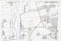 Castle Frome, OS Map Herefordshire XXVIII.14, 1887.jpg 1,307 × 897; 838 KB
-
 (1887) MAP OF CYPRUS.jpg 3,075 × 2,115; 2.48 MB
-

-
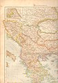 Balkan 1887 pages78.79.jpg 3,504 × 4,956; 5.15 MB
-
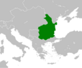 Bulgaria and Romania 1887.png 1,185 × 979; 139 KB
-
 Bulgaria and Romania 1887.svg 249 × 185; 459 KB
-
 Carte Arrondissement de Valenciennes - 1887 - Gallica.jpeg 7,795 × 10,032; 11.63 MB
-
 Carte des densités de population en Bretagne en 1887.png 635 × 472; 648 KB
-
 CarteSeisme1887.jpg 218 × 250; 35 KB
-
 Das heutige Europa - T.B. LCCN2009631645.tif 1,536 × 1,015; 1.49 MB
-
 Das heutige Europa.pdf 3,279 × 2,468; 6.77 MB
-

-


_MAP_OF_CYPRUS.jpg)
.jpg)


_-_Archives_nationales_(France).jpg)
.jpg)