Category:1889 maps of Europe
Temperate regions: North America · South America · Africa · Europe · Asia · – Polar regions: – Other regions:
English: 1889 maps of Europe
Español: Mapas de Europa en 1889
Suomi: Euroopan kartat vuodelta 1889
Română: Hărți ale Europei din 1889
Subcategories
This category has the following 12 subcategories, out of 12 total.
.
- 1889 maps of the British Empire (empty)
F
- 1889 maps of Finland (1 F)
G
I
R
S
- 1889 maps of Spain (7 F)
- 1889 maps of Switzerland (6 F)
U
- 1889 maps of Ukraine (5 F)
Media in category "1889 maps of Europe"
The following 17 files are in this category, out of 17 total.
-
 BAYER(1889) p367 Karte von Nordnorwegen und Nordschweden.jpg 6,296 × 4,108; 5.11 MB
-
 1889 Vuillemin Map of Paris, France - Geographicus - Paris-vuillemin-1889.jpg 6,000 × 4,173; 8.24 MB
-

-

-

-
-
-
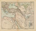 Afrika in 6 Blättern, Sheet 2. - DPLA - 39177aedfe3e739eea71ac7e1c8552db.jpg 1,000 × 846; 263 KB
-

-
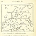
 Image taken from page 221 of '(Handbook of Commercial Geography.)' (11219807733).jpg 2,595 × 2,047; 1.27 MB
-
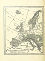
 Image taken from page 221 of '(Handbook of Commercial Geography.)' (16403882279).jpg 2,418 × 1,811; 777 KB
-
 Image taken from page 221 of 'Handbook of Commercial Geography' (11199685875).jpg 3,239 × 2,465; 1.54 MB
-
 Image taken from page 221 of 'Handbook of Commercial Geography' (16403089510).jpg 2,408 × 1,805; 826 KB
-
 Nouveau Plan complet illustré de la ville de Paris en 1889 by Vuillemin - Gallica.jpg 10,793 × 8,052; 18.88 MB
-

-

-

_p367_Karte_von_Nordnorwegen_und_Nordschweden.jpg)

.jpg)
.jpg)
%27_(11199491403).jpg)
.jpg)
.jpg)


%27_(11219807733).jpg)
%27_(16403882279).jpg)
.jpg)
.jpg)

.jpg)
.jpg)
.jpg)