Category:1896 maps of Louisiana
States of the United States: California · Connecticut · Georgia · Idaho · Illinois · Iowa · Kansas · Kentucky · Louisiana · Maine · Massachusetts · Michigan · Minnesota · Mississippi · Missouri · Montana · New Hampshire · New Jersey · New York · North Carolina · North Dakota · Ohio · Oklahoma · Oregon · Pennsylvania · Rhode Island · South Carolina · South Dakota · Tennessee · Texas · Virginia · Washington · West Virginia · Wisconsin · Wyoming – Washington, D.C.
| ← 1890 1891 1892 1893 1894 1895 1896 1898 1899 |
Subcategories
This category has the following 4 subcategories, out of 4 total.
Media in category "1896 maps of Louisiana"
The following 20 files are in this category, out of 20 total.
-
 338 of 'Elementary Physical Geography' (11301678294).jpg 1,368 × 1,298; 436 KB
-

-
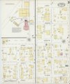
 Sanborn Fire Insurance Map from Alexandria, Rapides Parish, Louisiana. LOC sanborn03267 003-1.tif 6,450 × 7,650; 141.17 MB
-

-
 Sanborn Fire Insurance Map from Alexandria, Rapides Parish, Louisiana. LOC sanborn03267 003-2.tif 6,450 × 7,650; 141.17 MB
-

-
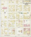
 Sanborn Fire Insurance Map from Alexandria, Rapides Parish, Louisiana. LOC sanborn03267 003-3.tif 6,450 × 7,650; 141.17 MB
-

-
 Sanborn Fire Insurance Map from Alexandria, Rapides Parish, Louisiana. LOC sanborn03267 003-4.tif 6,450 × 7,650; 141.17 MB
-
-
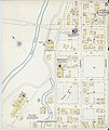
 Sanborn Fire Insurance Map from Alexandria, Rapides Parish, Louisiana. LOC sanborn03267 003-5.tif 6,450 × 7,650; 141.17 MB
-
 Louisiana. LOC 98688489.jpg 8,344 × 6,264; 10.55 MB
-
 Louisiana. LOC 98688489.tif 8,344 × 6,264; 149.54 MB
-
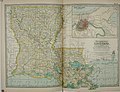
 Map of the State of Louisiana - NARA - 25464372.jpg 10,112 × 10,215; 9.36 MB
-

-

-

-

-

-
.jpg)


_(14774218104).jpg)