Category:1896 maps of Missouri
States of the United States: California · Connecticut · Georgia · Idaho · Illinois · Iowa · Kansas · Kentucky · Louisiana · Michigan · Mississippi · Missouri · Montana · New Jersey · New York · North Carolina · Ohio · Oklahoma · Oregon · Pennsylvania · South Carolina · South Dakota · Tennessee · Texas · Virginia · Washington · West Virginia · Wisconsin · Wyoming – Washington, D.C.
| ← 1890 1891 1892 1893 1894 1895 1896 1897 1898 1899 → |
Subcategories
This category has the following 4 subcategories, out of 4 total.
J
Media in category "1896 maps of Missouri"
The following 9 files are in this category, out of 9 total.
-

-
 Saint Louis in 1896. LOC 75694662.jpg 12,256 × 8,160; 22.31 MB
-
 Sanborn Fire Insurance Map from Frankford, Pike County, Missouri. LOC sanborn04662 001.jpg 6,450 × 7,650; 3.71 MB
-
 Sanborn Fire Insurance Map from Frankford, Pike County, Missouri. LOC sanborn04662 001.tif 6,450 × 7,650; 141.17 MB
-
 Sanborn Fire Insurance Map from Kearney, Clay County, Missouri. LOC sanborn04721 001.jpg 6,450 × 7,650; 3.7 MB
-
 Sanborn Fire Insurance Map from Kearney, Clay County, Missouri. LOC sanborn04721 001.tif 6,450 × 7,650; 141.17 MB
-
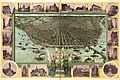
 St Louis Birdseye Map 1896.jpg 10,753 × 6,999; 14.21 MB
-
 St. Louis in 1896. LOC 75694663.jpg 12,224 × 7,264; 22.75 MB
-
 St. Louis in 1896. LOC 75694663.tif 12,224 × 7,264; 254.05 MB
.jpg)


