Category:1896 maps of Sudan
Media in category "1896 maps of Sudan"
The following 9 files are in this category, out of 9 total.
-
 SLATIN(1896) p701 MAP OF KHARTUM AND OMDURMAN.jpg 2,761 × 2,829; 3.45 MB
-
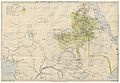 SLATIN(1896) p703 MAHDIST INFLUENCE IN 1895.jpg 4,792 × 3,323; 7.17 MB
-
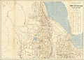
 Map showing the British advance upon Dongola. LOC 2012591520.jpg 2,550 × 3,357; 1.02 MB
-
 Map showing the British advance upon Dongola. LOC 2012591520.tif 2,550 × 3,357; 24.49 MB
-
 Nile between Khartum and Dongola (1896).jpg 2,887 × 2,736; 1.27 MB
-
 Nuova Carta Dei Domini E Protettorati Italiani Nell'Eritrea e Regioni Limitrofe.png 9,701 × 6,917; 144.53 MB
-
-
 Sketch-Map of the North East Sudan - DPLA - f2a6ee4b750f0c80e7f769ceab989130.jpg 813 × 1,000; 169 KB
-
 Slatins Reisen im Reich des Mahdi.jpg 2,544 × 3,504; 2.46 MB
_p701_MAP_OF_KHARTUM_AND_OMDURMAN.jpg)
_p703_MAHDIST_INFLUENCE_IN_1895.jpg)

.jpg)


