File:Map showing the British advance upon Dongola. LOC 2012591520.tif

Size of this JPG preview of this TIF file: 455 × 599 pixels. Other resolutions: 182 × 240 pixels | 364 × 480 pixels | 583 × 768 pixels | 778 × 1,024 pixels | 2,550 × 3,357 pixels.
Original file (2,550 × 3,357 pixels, file size: 24.49 MB, MIME type: image/tiff)
Captions
Captions
Add a one-line explanation of what this file represents
Summary edit
| Description |
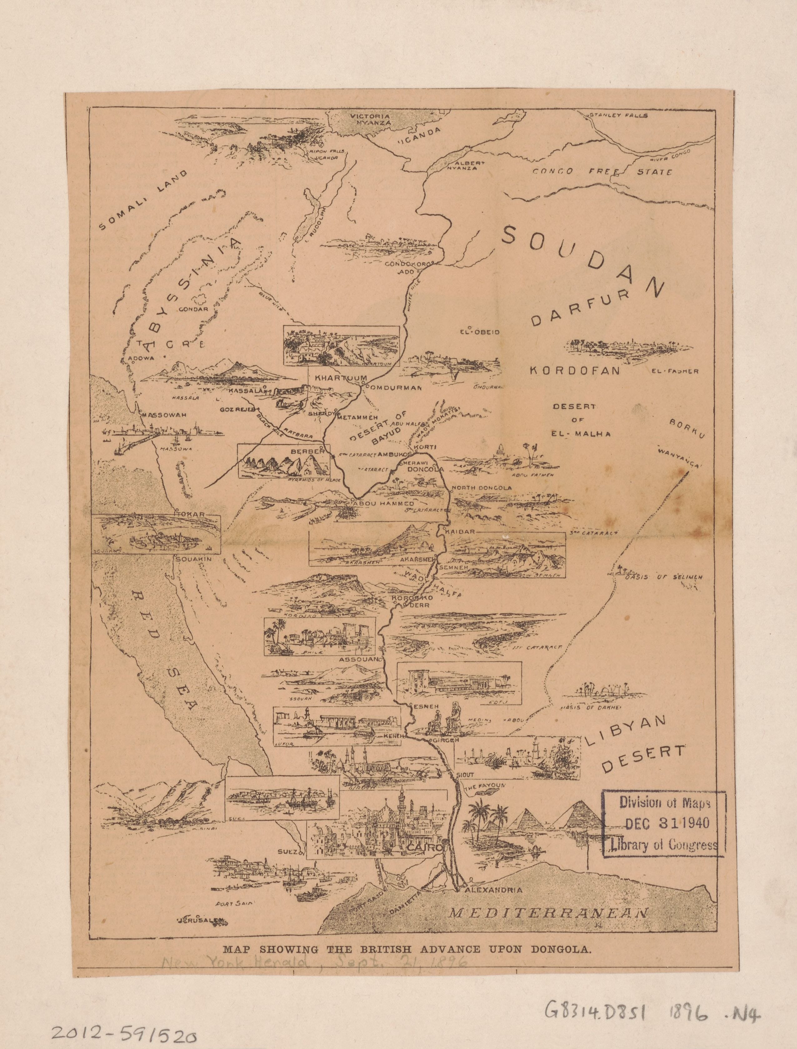
English: Shows "The Dongola Campaign", where Kitchener commanded the Anglo-Egyptian forces at the battles of "Firket" and "Hafir" against the Dervishes of the Mahdi movement in Sudan before going on to Dongola. The forces entered Dongola in September 1896. Gift; A.P. Loper; Dec. 13, 1940. Map is published in the New York Herald, Sept. 21, 1896. Available also through the Library of Congress Web site as a raster image. |
||
| Title | Map showing the British advance upon Dongola. | ||
| Shelf ID | G8314.D8S1 1896 .N4 | ||
| Date | |||
| Source | https://www.loc.gov/item/2012591520/ | ||
| Author | New York Herald Company; Mahdī, Muḥammad Aḥmad; Kitchener, Horatio Herbert Kitchener | ||
| Permission (Reusing this file) |
|
||
| Other versions |
|
||
| Location | Sudan · Dunqulah. · Dunqulah | ||
| Part of | American Memory · Cities And Towns · Catalog · Geography And Map Division | ||
| Subject | Dunqulah · Sudan · Pictorial Maps · Dunqulah (Sudan) · Maps · History |


Licensing edit
|
This is a faithful photographic reproduction of a two-dimensional, public domain work of art. The work of art itself is in the public domain for the following reason:
The official position taken by the Wikimedia Foundation is that "faithful reproductions of two-dimensional public domain works of art are public domain".
This photographic reproduction is therefore also considered to be in the public domain in the United States. In other jurisdictions, re-use of this content may be restricted; see Reuse of PD-Art photographs for details. | ||||
File history
Click on a date/time to view the file as it appeared at that time.
| Date/Time | Thumbnail | Dimensions | User | Comment | |
|---|---|---|---|---|---|
| current | 18:50, 13 October 2019 |  | 2,550 × 3,357 (24.49 MB) | Fæ (talk | contribs) | LOC Maps https://www.loc.gov/item/2012591520/ #20656 |
You cannot overwrite this file.
File usage on Commons
The following page uses this file: