Category:1898 maps of Pennsylvania
States of the United States: Alaska · California · Connecticut · Florida · Georgia · Illinois · Indiana · Iowa · Kentucky · Louisiana · Maine · Maryland · Massachusetts · Michigan · Minnesota · Mississippi · Missouri · Montana · New Hampshire · New Jersey · New Mexico · New York · North Carolina · North Dakota · Ohio · Oklahoma · Oregon · Pennsylvania · Rhode Island · South Carolina · South Dakota · Tennessee · Texas · Vermont · Virginia · Washington · West Virginia · Wisconsin – Washington, D.C.
Puerto Rico
Puerto Rico
| ← 1890 1891 1892 1893 1894 1895 1896 1897 1898 1899 → |
Subcategories
This category has the following 13 subcategories, out of 13 total.
Media in category "1898 maps of Pennsylvania"
The following 12 files are in this category, out of 12 total.
-
 217 of 'The Critical Period of American History ... Illustrated, etc' (11248762236).jpg 1,413 × 2,243; 375 KB
-
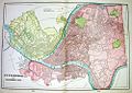
 Allegheny City map.jpg 1,586 × 1,077; 770 KB
-
 Allegheny City.jpg 500 × 353; 36 KB
-
 Bernville Berks Co PA 1898.jpg 7,160 × 3,720; 8.63 MB
-
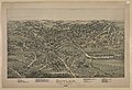 Butler, Butler County Penn LCCN2003681810.jpg 9,760 × 6,654; 11.35 MB
-
 Newmanstown and Sheridan, Pennsylvania 1898. LOC 75696510.jpg 6,216 × 3,880; 7.3 MB
-
 Newmanstown and Sheridan, Pennsylvania 1898. LOC 75696510.tif 6,216 × 3,880; 69 MB
-

-
 Sanborn Fire Insurance Map from Linesville, Crawford County, Pennsylvania. LOC sanborn07772 004.tif 6,450 × 7,650; 141.17 MB
-
 The city of Reading, Pennsylvania 1898. LOC 74693142.jpg 9,872 × 6,496; 17.1 MB
-
 Wernersville, Pennsylvania. LOC 2013589300.jpg 9,441 × 6,918; 16.34 MB
-
 Womelsdorf, Pennsylvania. LOC 2012585020.jpg 5,280 × 3,664; 5.59 MB
.jpg)


