Category:18th century maps of Finistère
Departments of Metropolitan France: Ain [01] · Aisne [02] · Alpes-de-Haute-Provence [04] · Alpes-Maritimes [06] · Ardèche [07] · Aube [10] · Bouches-du-Rhône [13] · Calvados [14] · Charente [16] · Corrèze [19] · Côte-d’Or [21] · Dordogne [24] · Eure [27] · Eure-et-Loir [28] · Finistère [29] · Gard [30] · Haute-Garonne [31] · Ille-et-Vilaine [35] · Indre-et-Loire [37] · Jura [39] · Loir-et-Cher [41] · Loire-Atlantique [44] · Manche [50] · Marne [51] · Haute-Marne [52] · Morbihan [56] · Moselle [57] · Nord [59] · Oise [60] · Orne [61] · Pas-de-Calais [62] · Hautes-Pyrénées [65] · Haut-Rhin [68] · Saône-et-Loire [71] · Seine-Maritime [76] · Seine-et-Marne [77] · Yvelines [78] · Var [83] · Vendée [85] · Hauts-de-Seine [92]
Subcategories
This category has the following 5 subcategories, out of 5 total.
C
F
I
Media in category "18th century maps of Finistère"
The following 19 files are in this category, out of 19 total.
-
 054 Carte de Penmarc'h vers 1780.JPG 2,199 × 2,709; 4.2 MB
-
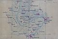
 114 Plan de Châteauneuf-du-Faou XVIIIème siècle.jpg 2,760 × 1,812; 2.16 MB
-
 Bellin, Carte Glénan, 1764.JPG 1,819 × 2,302; 1.11 MB
-
 Carte Audierne vers 1770.jpg 571 × 381; 149 KB
-
 Carte Baie d'Audierne 2e moitié XVIIIe.jpg 642 × 485; 132 KB
-
 Carte Châteaulin 1780.JPEG 1,396 × 940; 617 KB
-
 Carte de Berthou de Launay 1723.jpg 1,174 × 830; 633 KB
-
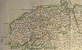 Carte de l'évêché de Léon - 1775.jpg 4,355 × 2,662; 10.55 MB
-
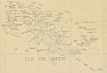 Carte de l'ïle de Sein en 1771.jpg 1,014 × 693; 375 KB
-
 Carte de Portsall fin XVIIIe.jpg 438 × 572; 169 KB
-
 Carte Kerlouan Plounéour-Trez fin XVIIIe.jpg 1,184 × 890; 775 KB
-
 Carte Landévennec 1785.jpg 723 × 560; 187 KB
-
 Carte Primelin fin XVIIIe.jpg 977 × 606; 286 KB
-
 Guissény carte 1780.jpg 988 × 722; 507 KB
-
 Landunvez fin XVIIIe carte.jpg 896 × 476; 233 KB
-
 Plan de Loctudy (1771-1785).jpg 1,206 × 1,054; 196 KB
-
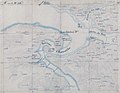
 Plan du Conquet et des environs vers 1700.jpg 612 × 431; 206 KB
-
 Plan Mengant 1724.jpg 962 × 1,290; 679 KB
-
 Île des Saints de Keranstrec 1754.jpg 1,289 × 928; 399 KB


.jpg)


