Category:1902 maps of California
States of the United States: California · Illinois · Iowa · Michigan · Minnesota · Missouri · New York · Ohio · Oklahoma · Pennsylvania · Texas · Virginia · Wisconsin – Washington, D.C.
| ← 1900 1901 1902 1903 1905 1906 1907 1908 1909 → |
Subcategories
This category has only the following subcategory.
Media in category "1902 maps of California"
The following 5 files are in this category, out of 5 total.
-
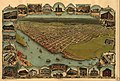 Eureka California Illustrated Map1902.jpg 1,498 × 1,016; 1.56 MB
-
 Eureka, Humboldt County, California. LOC 75693089.jpg 12,336 × 8,496; 19.46 MB
-
 Placer County California LOC 2007633931.jpg 9,304 × 5,974; 6.61 MB
-
 Placer County California LOC 2007633931.tif 9,304 × 5,974; 159.02 MB
-
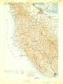 Santa-Cruz-Quadrangle-1902.png 6,623 × 8,747; 60.94 MB


