Category:1900s maps of California
States of the United States: Alabama · Alaska · Arizona · Arkansas · California · Colorado · Connecticut · Delaware · Florida · Georgia · Hawaii · Idaho · Illinois · Indiana · Iowa · Kansas · Kentucky · Louisiana · Maine · Maryland · Massachusetts · Michigan · Minnesota · Mississippi · Missouri · Montana · Nebraska · Nevada · New Hampshire · New Jersey · New Mexico · New York · North Carolina · North Dakota · Ohio · Oklahoma · Oregon · Pennsylvania · Rhode Island · South Carolina · South Dakota · Tennessee · Texas · Utah · Vermont · Virginia · Washington · West Virginia · Wisconsin · Wyoming – Washington, D.C.
Puerto Rico
Puerto Rico
Subcategories
This category has the following 11 subcategories, out of 11 total.
- 1900 maps of California (3 F)
- 1901 maps of California (8 F)
- 1903 maps of California (19 F)
- 1906 maps of California (5 F)
S
Media in category "1900s maps of California"
The following 15 files are in this category, out of 15 total.
-
 Sacramento River Flood, California 1904.jpg 718 × 1,218; 206 KB
-
 Bullfrog Goldfield Railroad 1908 north of Bullfrog.jpg 759 × 484; 203 KB
-
 Bullfrog Goldfield Railroad 1908 northern section.jpg 623 × 1,618; 629 KB
-
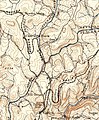
 CA Napa Mankas 1902 125000.jpg 435 × 459; 78 KB
-
 CA Randsburg 1903 62500.jpg 844 × 1,390; 564 KB
-
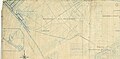
 California, Shasta and Eastern Railway 1901 northern portion.jpg 212 × 544; 64 KB
-
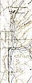
 Colfax 1902.jpg 524 × 636; 205 KB
-
 Map of the Los Angeles-Pacific R.R (uclamss 294 b96 1).jpg 7,728 × 6,303; 14.65 MB
-
 Map of the Venice-Inglewood.jpg 4,587 × 2,243; 3.84 MB
-
 OSRR with Lobitos and Tunitas Stations.jpg 2,849 × 2,629; 1.14 MB
-
 Penn RR 1906 sheet2.jpg 7,821 × 3,949; 5.3 MB
-
 Pitt River, CA 1901 125000.jpg 1,037 × 445; 311 KB
-
 Railway Route I Southern California And Arizona - Pg-345.jpg 1,004 × 693; 295 KB
-
 Rumsey Branch of SP 1905.jpg 1,728 × 1,321; 486 KB
-
 Vallejo 1902.jpg 856 × 795; 424 KB


.jpg)


