Category:1900s maps of Oregon
States of the United States: Alabama · Alaska · Arizona · Arkansas · California · Colorado · Connecticut · Delaware · Florida · Georgia · Hawaii · Idaho · Illinois · Indiana · Iowa · Kansas · Kentucky · Louisiana · Maine · Maryland · Massachusetts · Michigan · Minnesota · Mississippi · Missouri · Montana · Nebraska · Nevada · New Hampshire · New Jersey · New Mexico · New York · North Carolina · North Dakota · Ohio · Oklahoma · Oregon · Pennsylvania · Rhode Island · South Carolina · South Dakota · Tennessee · Texas · Utah · Vermont · Virginia · Washington · West Virginia · Wisconsin · Wyoming – Washington, D.C.
Puerto Rico
Puerto Rico
Media in category "1900s maps of Oregon"
The following 6 files are in this category, out of 6 total.
-
 Capital city of Oregon, Salem. LOC 75694941.jpg 11,080 × 8,208; 20.11 MB
-
 The new international encyclopaedia (1905) (14595180789).jpg 1,724 × 2,122; 645 KB
-
 1909 U.S.G.S. Geological Survey of Vancouver City - Geographicus - Vancounver-USCS-1909.jpg 2,900 × 2,189; 1.01 MB
-
 Geology and water resources of the Harney Basin region, Oregon (1909) (14783092885).jpg 2,557 × 2,627; 836 KB
-
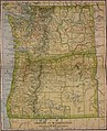
 NIE 1905 Oregon and Washington.jpg 1,565 × 1,927; 1.56 MB
-
 The Overland Route 1908 Map.jpg 1,017 × 635; 375 KB

_(14595180789).jpg)

_(14783092885).jpg)

