Category:1900s maps of Indiana
States of the United States: Alabama · Alaska · Arizona · Arkansas · California · Colorado · Connecticut · Delaware · Florida · Georgia · Hawaii · Idaho · Illinois · Indiana · Iowa · Kansas · Kentucky · Louisiana · Maine · Maryland · Massachusetts · Michigan · Minnesota · Mississippi · Missouri · Montana · Nebraska · Nevada · New Hampshire · New Jersey · New Mexico · New York · North Carolina · North Dakota · Ohio · Oklahoma · Oregon · Pennsylvania · Rhode Island · South Carolina · South Dakota · Tennessee · Texas · Utah · Vermont · Virginia · Washington · West Virginia · Wisconsin · Wyoming – Washington, D.C.
Puerto Rico
Puerto Rico
Subcategories
This category has the following 5 subcategories, out of 5 total.
1
Media in category "1900s maps of Indiana"
The following 9 files are in this category, out of 9 total.
-
 The street railway review (1891) (14571877759).jpg 970 × 2,100; 175 KB
-

-
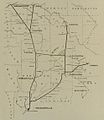 IndianaUnionTractionCo.1904map.jpg 985 × 1,136; 79 KB
-
 NIE 1905 Indiana.jpg 1,615 × 2,001; 1.17 MB
-

-
 Map of Indiana showing Interurban Railways c 1907.png 1,360 × 1,952; 1.14 MB
-

-
 Ohio Electric Railway map (14575084010).jpg 2,444 × 1,272; 583 KB
-
 The street railway review (1891) (14736577406).jpg 2,064 × 1,766; 476 KB
_(14571877759).jpg)
_(14597937158).jpg)


_(14755445801).jpg)

_(14578798768).jpg)
.jpg)
_(14736577406).jpg)