Category:1900s maps of West Virginia
States of the United States: Alabama · Alaska · Arizona · Arkansas · California · Colorado · Connecticut · Delaware · Florida · Georgia · Hawaii · Idaho · Illinois · Indiana · Iowa · Kansas · Kentucky · Louisiana · Maine · Maryland · Massachusetts · Michigan · Minnesota · Mississippi · Missouri · Montana · Nebraska · Nevada · New Hampshire · New Jersey · New Mexico · New York · North Carolina · North Dakota · Ohio · Oklahoma · Oregon · Pennsylvania · Rhode Island · South Carolina · South Dakota · Tennessee · Texas · Utah · Vermont · Virginia · Washington · West Virginia · Wisconsin · Wyoming – Washington, D.C.
Puerto Rico
Puerto Rico
Subcategories
This category has the following 4 subcategories, out of 4 total.
- 1900 maps of West Virginia (4 F)
- 1905 maps of West Virginia (4 F)
- 1906 maps of West Virginia (2 F)
- 1908 maps of West Virginia (1 F)
Media in category "1900s maps of West Virginia"
The following 2 files are in this category, out of 2 total.
-
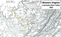 Western Virginia 1862.png 1,066 × 651; 1.39 MB
-
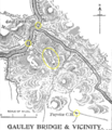 GauleyBridgeFayetteville.png 564 × 653; 268 KB

