Category:1900s maps of Washington, D.C.
States of the United States: Alabama · Alaska · Arizona · Arkansas · California · Colorado · Connecticut · Delaware · Florida · Georgia · Hawaii · Idaho · Illinois · Indiana · Iowa · Kansas · Kentucky · Louisiana · Maine · Maryland · Massachusetts · Michigan · Minnesota · Mississippi · Missouri · Montana · Nebraska · Nevada · New Hampshire · New Jersey · New Mexico · New York · North Carolina · North Dakota · Ohio · Oklahoma · Oregon · Pennsylvania · Rhode Island · South Carolina · South Dakota · Tennessee · Texas · Utah · Vermont · Virginia · Washington · West Virginia · Wisconsin · Wyoming – Washington, D.C.
Puerto Rico
Puerto Rico
Subcategories
This category has the following 8 subcategories, out of 8 total.
- 1900 maps of Washington, D.C. (36 F)
- 1901 maps of Washington, D.C. (28 F)
- 1902 maps of Washington, D.C. (17 F)
Media in category "1900s maps of Washington, D.C."
The following 17 files are in this category, out of 17 total.
-

-
 Plat of proposed reservation at Fort Stevens, near Brightwood, D.C. LOC 88690824.jpg 4,370 × 5,721; 4.14 MB
-
 McMillan Plan.jpg 1,050 × 678; 343 KB
-
 The new international encyclopaedia (1905) (14773960604).jpg 2,236 × 1,706; 600 KB
-
 1908-Mar-29 Evening Star Montrose Park Washington DC.jpg 608 × 641; 249 KB
-
 1909 map of Downtown Washington, D.C..jpg 3,000 × 2,193; 908 KB
-
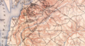
 EB1911 Maryland and Delaware.jpg 2,621 × 1,843; 2.98 MB
-
 Map of Presbyterian Burying Ground DC - 1903.jpg 1,730 × 1,279; 1.27 MB
-
 Map of the City of Washington Showing Location of Fatal Cases of Consumption.jpg 8,520 × 8,940; 12.86 MB
-
 Map of the District of Columbia - 1901 LOC 87694449.jpg 8,820 × 8,149; 13.14 MB
-
 NIE 1905 Maryland and Delaware.jpg 2,159 × 1,626; 1.47 MB
-
 NIE 1905 Washington (District of Columbia) - map.jpg 2,154 × 1,648; 977 KB
-
 Oxon Run.png 1,180 × 639; 2.11 MB
-

-
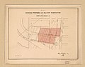 Plat showing proposed U.S. military reservation at Fort Stevens D.C.jpg 1,652 × 1,291; 187 KB
-

-
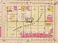
 Prather's Alley 1904 map.jpg 917 × 437; 71 KB


_(14773960604).jpg)


_-_map.jpg)


.jpg)
