Category:1900 maps of Washington, D.C.
States of the United States: California · Connecticut · Florida · Georgia · Idaho · Illinois · Indiana · Iowa · Kansas · Massachusetts · Michigan · Minnesota · Missouri · Nebraska · New Jersey · New York · North Carolina · North Dakota · Ohio · Oklahoma · Pennsylvania · Rhode Island · South Carolina · South Dakota · Tennessee · Texas · Utah · Vermont · Virginia · Washington · West Virginia · Wisconsin · Wyoming – Washington, D.C.
| ← 1900 1901 1902 1903 1904 1905 1907 1909 → |
Media in category "1900 maps of Washington, D.C."
The following 36 files are in this category, out of 36 total.
-
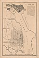
 (Map of Scott Circle N.W., Washington D.C., and adjacent parklands) LOC 88693087.jpg 6,415 × 4,477; 2.6 MB
-
 (Map of Scott Circle N.W., Washington D.C., and adjacent parklands) LOC 88693087.tif 6,415 × 4,477; 82.17 MB
-
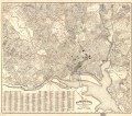
 Alexandria City showing connections with Washington. LOC 89692658.jpg 6,309 × 9,293; 4.91 MB
-
 Alexandria City showing connections with Washington. LOC 89692658.tif 6,309 × 9,293; 167.74 MB
-

-
 Fernwood Heights - (Washington D.C.) LOC 88690812.jpg 5,161 × 3,916; 1.81 MB
-
 Fernwood Heights - (Washington D.C.) LOC 88690812.tif 5,161 × 3,916; 57.82 MB
-
 Fort Driveway - (Washington D.C.). LOC 88690813.jpg 22,339 × 8,991; 29.28 MB
-

-

-
 Map of landholdings along the Anacostia River in Washington, D.C.. LOC 88690689.jpg 24,811 × 11,018; 35.43 MB
-
 Map of landholdings along the Anacostia River in Washington, D.C.. LOC 88690689.tif 24,811 × 11,018; 782.11 MB
-

-

-
 Map of the city of Washington showing street railway lines. LOC 87695722.jpg 5,611 × 7,157; 4.8 MB
-
 Map of the city of Washington showing street railway lines. LOC 87695722.tif 5,611 × 7,157; 114.89 MB
-

-

-
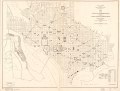
 Map of the city of Washington showing United States reservations LOC 87694438.jpg 10,952 × 8,341; 9.47 MB
-
 Map of the city of Washington showing United States reservations LOC 87694438.tif 10,952 × 8,341; 261.36 MB
-

-
 Map of the city of Washington showing water mains and fire hydrants - January 15th 1900 LOC 87695517.tif 8,582 × 10,306; 253.05 MB
-
 Map of the District of Columbia. LOC 87691435.jpg 8,676 × 6,524; 11.17 MB
-

-
 New map, Washington, D.C. - compiled from official surveys and best authorities. LOC 87691433.tif 9,538 × 8,387; 228.87 MB
-

-

-

-

-
 Study for the establishment and use of Potomac Park - (Washington D.C.) LOC 88690914.jpg 16,616 × 8,731; 13.56 MB
-
 Study for the establishment and use of Potomac Park - (Washington D.C.) LOC 88690914.tif 16,616 × 8,731; 415.06 MB
-

-

-
 Topographical map of Washington, D.C. - 1899-1900 LOC 87694383.jpg 16,487 × 12,085; 36.82 MB
-

-

_LOC_88693087.jpg)

_(18247654858).jpg)
_LOC_88690812.jpg)
_LOC_88693244.jpg)


_improved_during_fiscal_year_ending_June_30th_1900_LOC_87694437.jpg)


_LOC_88693079.jpg)
_LOC_88693082.jpg)
_LOC_88690914.jpg)


._LOC_88690813.jpg)