Category:1900 maps of Idaho
States of the United States: California · Connecticut · Georgia · Idaho · Illinois · Iowa · Kansas · Michigan · Minnesota · Missouri · Nebraska · New Jersey · New York · North Carolina · North Dakota · Ohio · Oklahoma · Pennsylvania · South Carolina · South Dakota · Tennessee · Texas · Utah · Virginia · Washington · West Virginia · Wisconsin · Wyoming – Washington, D.C.
| 1900 1901 1905 1907 1908 1909 → |
Media in category "1900 maps of Idaho"
The following 5 files are in this category, out of 5 total.
-
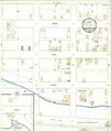
 Sanborn Fire Insurance Map from Idaho City, Boise County, Idaho. LOC sanborn01615 001.jpg 6,450 × 7,650; 3.29 MB
-
 Sanborn Fire Insurance Map from Juliaetta, Latah County, Idaho. LOC sanborn01619 002.jpg 6,450 × 7,650; 2.57 MB
-
 Sanborn Fire Insurance Map from Juliaetta, Latah County, Idaho. LOC sanborn01619 002.tif 6,450 × 7,650; 141.17 MB
-

-
 Sanborn Fire Insurance Map from Saint Anthony, Fremont County, Idaho. LOC sanborn01669 001.tif 6,450 × 7,650; 141.17 MB


