Category:1980s maps of California
States of the United States: Alabama · Alaska · Arizona · Arkansas · California · Colorado · Connecticut · Delaware · Florida · Georgia · Hawaii · Kentucky · Louisiana · Maine · Maryland · Massachusetts · Mississippi · Nebraska · New Hampshire · New Jersey · New York · North Carolina · Ohio · Oklahoma · Pennsylvania · Rhode Island · South Carolina · Tennessee · Texas · Utah · Vermont · Virginia · West Virginia – Washington, D.C.
Puerto Rico
Puerto Rico
Subcategories
This category has the following 8 subcategories, out of 8 total.
- 1980 maps of California (7 F)
- 1982 maps of California (1 F)
- 1983 maps of California (1 F)
- 1984 maps of California (1 F)
- 1987 maps of California (2 F)
- 1989 maps of California (1 F)
S
Media in category "1980s maps of California"
The following 3 files are in this category, out of 3 total.
-

-
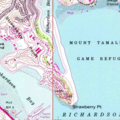 Aramburu Island, USGS, 1980.png 582 × 582; 710 KB
-
 Wendel Quadrangle, Provisional Edition 1988 - DPLA - f860000ab79d7de30598e1f118565c5e.jpg 8,800 × 10,829; 9.17 MB


